Jim Tang
Blue sky is caused by Rayleigh scattering
- Reposted by Jim Tang[Not loaded yet]
- Reposted by Jim Tang[Not loaded yet]
- Reposted by Jim Tang[Not loaded yet]
- Reposted by Jim TangMy crankiest belief is that we are now being sold on solutions to problems which only exist because we've let others convince us they exist. That is what "innovation" seems to be in 2025. There's a level of introspection that's just not happening these days re: what actually needs to bother us.
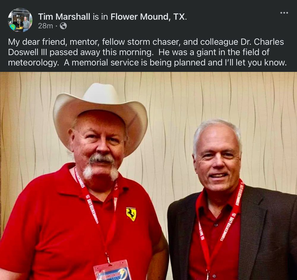
- Reposted by Jim TangVery sad news. I learned more about severe local convective storms from Chuck Doswell than anyone else. He was a friend and mentor.
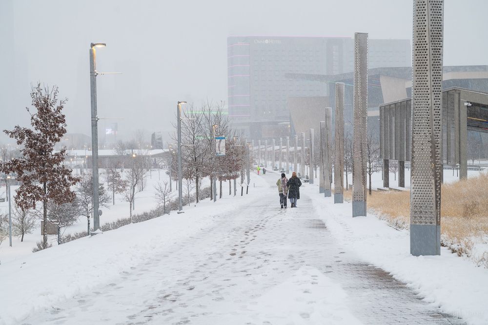
- A snow day in Oklahoma.
- Reposted by Jim TangFeatures of Adulthood xkcd.com/3034
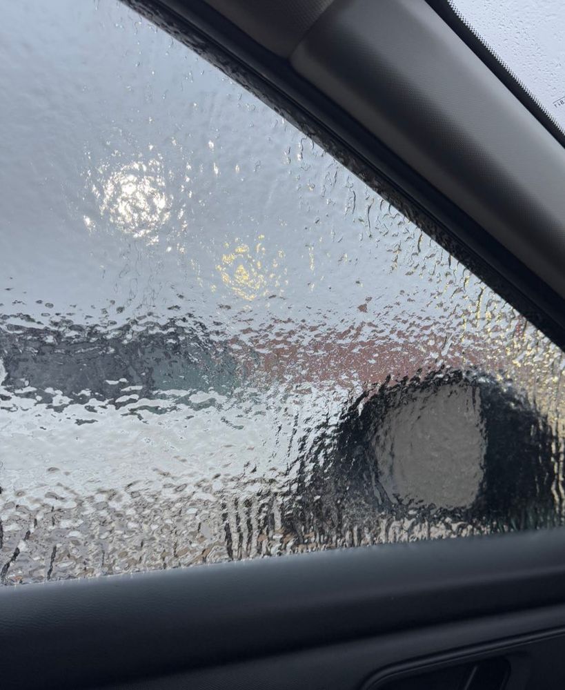
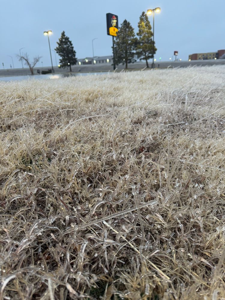
- Glaze is slippery. More later #kswx
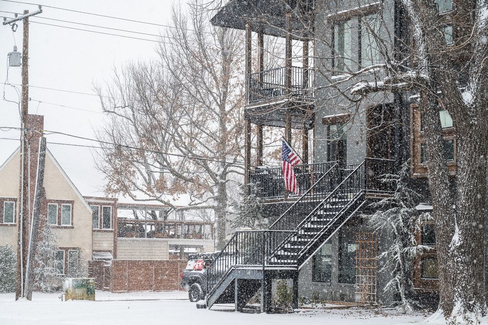
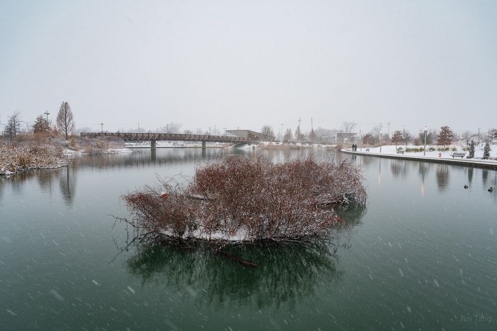
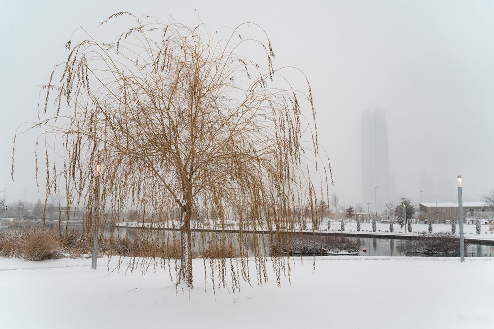
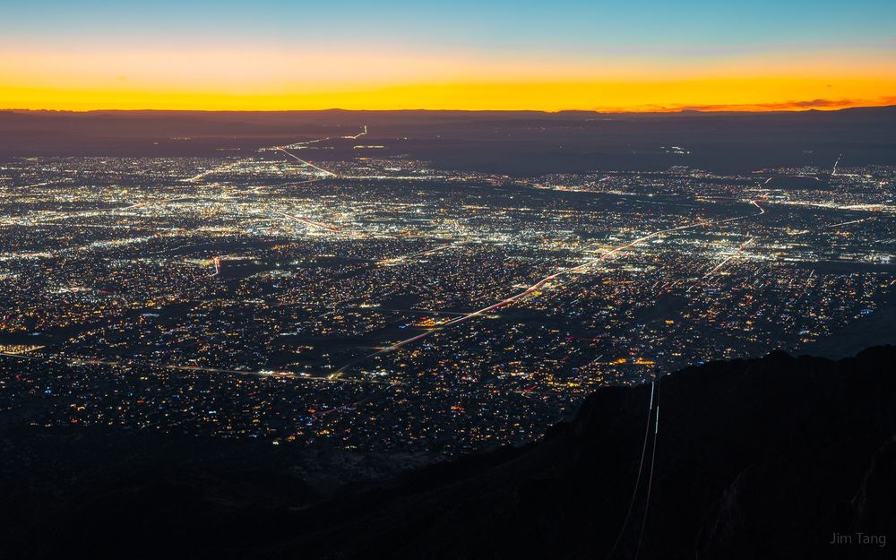
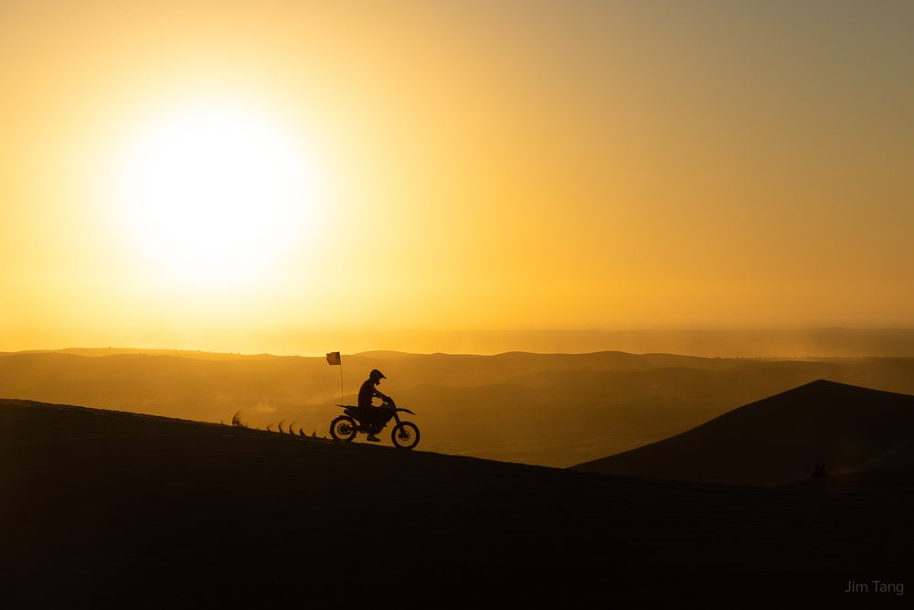
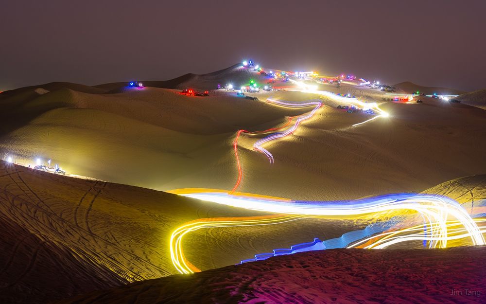
- Four photos I took in the closing days of 2024
- I have a rough hypothesis that patterns favorable for plentiful California precipitation, Plains tornadoes, and I-95 snowstorms tend to cluster together over multiyear timescales. Occam's Razor says to look at the first EOF of NH 500mb variability: the NAO.
- Reposted by Jim Tang[Not loaded yet]
- REEEEEEEE
- Reposted by Jim Tang[Not loaded yet]
- Damnit what
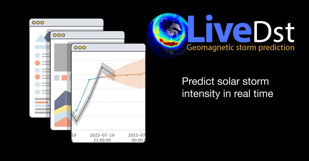
- Reposted by Jim TangWant the most sophisticated machine learning prediction of geomagnetic storming on the planet? SWx TREC’s LiveDst model gives 1- and 6-hour forecasts of the geomagnetic Dst index with quantified uncertainty - a first in the space weather forecasting world! swx-trec.com/dst/
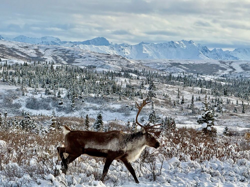
- Reposted by Jim TangAlaska is pretty cool
- Reposted by Jim TangWhile Bluesky looks like other social apps on the surface, it’s actually quite different. It’s an open network. I blogged about it here:
- Just learned that the drive from San Fransisco to Seattle is only 12 hours and I regret not having taken that drive when I lived in California
- I can't tell if this is accurate, and a reflection of the mass migration of the wx community, or just topics people who migrate to bsky tend to enjoy, or some influence of nominative determinism
- Reposted by Jim Tang[Not loaded yet]
- Reposted by Jim Tang[Not loaded yet]
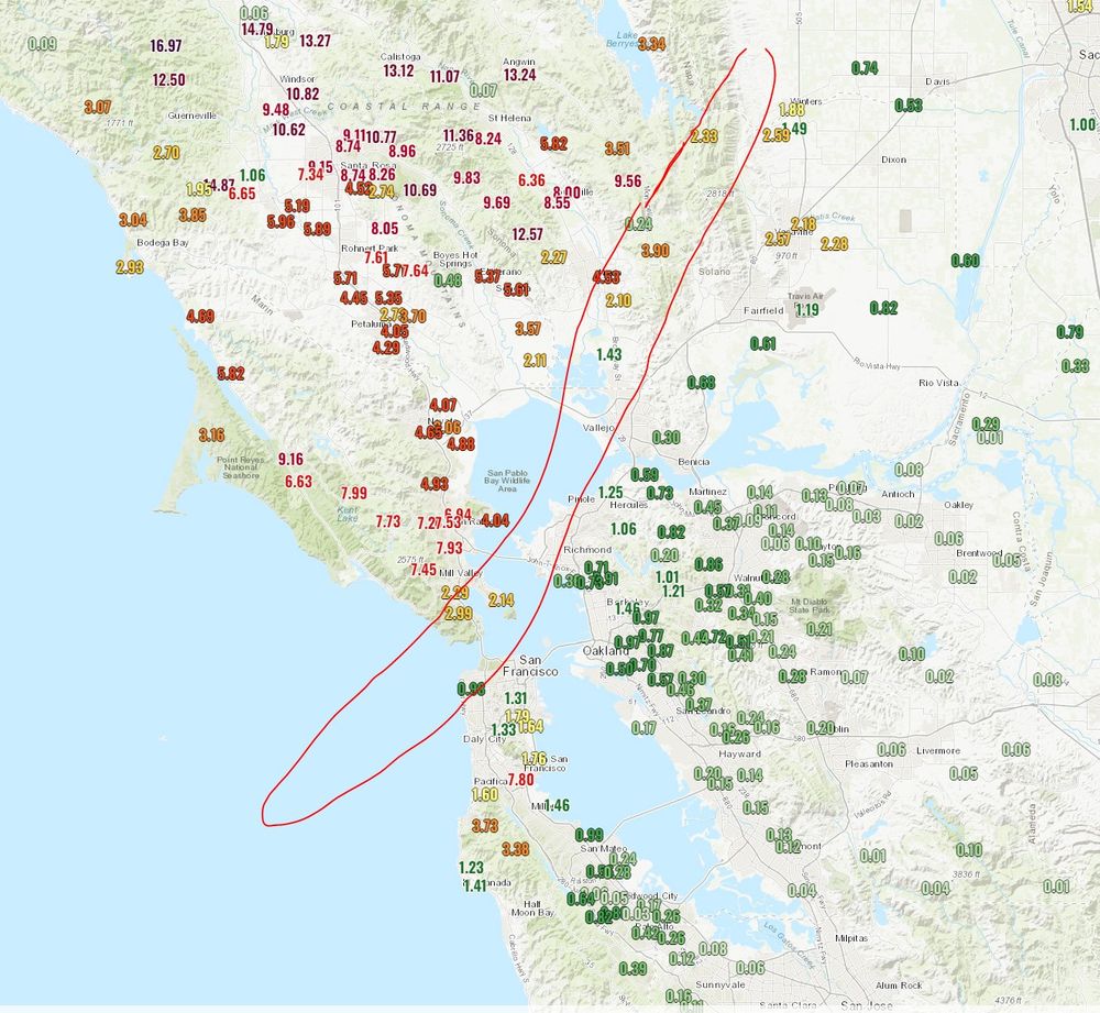
- Some intense precip gradients across the San Francisco Bay Area. Between San Rafael and Richmond (a 20-min drive across a bridge) the 48hr rain totals go from 7" to 0.7". Rain shadowed areas near/east of Mt. Diablo and in the Santa Clara Valley have generally received < a tenth of a inch.
- Reposted by Jim TangHello from the Tornado Archive team, Bluesky! Tornado Archive is a website dedicated to worldwide tornado history, climatology, and data visualization. Check out our data viewer!
- Reposted by Jim Tang[Not loaded yet]
- Reposted by Jim Tang[Not loaded yet]
- Reposted by Jim Tang[Not loaded yet]
- I'm not sure it was "obviously" going to be a blowout. First off, there's an incumbent disadvantage here where many people are seeking to leave the model of "big tech company controlling content distribution via algorithms on large platforms" and more focused on smaller niche communities 1/2
- Reposted by Jim Tang[Not loaded yet]
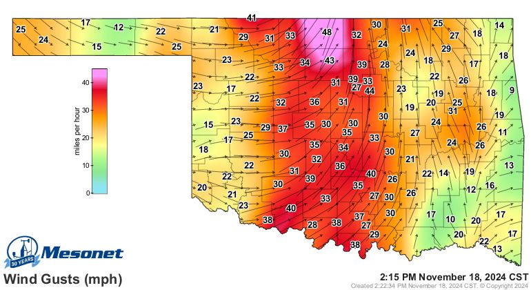
- Northern Oklahoma feeling a little “sting”y right now
- This is about as slam dunk of a California atmospheric river pattern as you can get. Dual high pressure blocking patterns over Alaska and the Davis Strait/Hudson Bay.
- Reposted by Jim Tang[Not loaded yet]
- Reposted by Jim TangBluesky explained in 60 seconds!
- Reposted by Jim Tang[Not loaded yet]
- Typhoon #Manyi is putting on an absolute clinic today.
- Reposted by Jim Tang[Not loaded yet]
- Reposted by Jim TangA number of artists and creators have made their home on Bluesky, and we hear their concerns with other platforms training on their data. We do not use any of your content to train generative AI, and have no intention of doing so.
- Reposted by Jim TangIn honor of all the new arrivals, I'm sharing one of my favorite videos. It shows 24 hours of Earth's rotation, with the camera locked to the sky instead of the ground. We're all hanging out on this spinning rock. Brilliant work by Bartosz Wojczyński. 🧪 artuniverse.eu/gallery/1907...
- The blues and greens in the first image are insane!
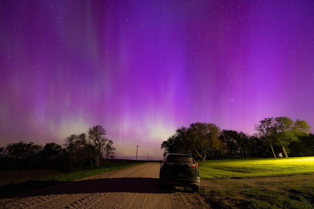
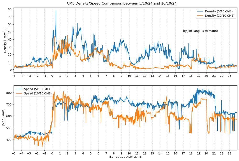
- This tracks with the blue/purple aurora colors seen on the early morning of 5/11 close to sunrise during the G5 storm- coincided with the sunlight energy and a boost in solar wind speeds around that time (hr 19, blue line bottom plot)
- The cool thing about Bluesky is the technical people are active (& hence dogfooding!) on the platform and transparent about the algorithms involved. Emphasis here is on open, extensible ecosystems rather than closed ones that we are used to on more established platforms.
- Bluesky is kicking tonight!
- Naming my new band "Invalid Handle" to pay homage to Bluesky accounts everywhere today
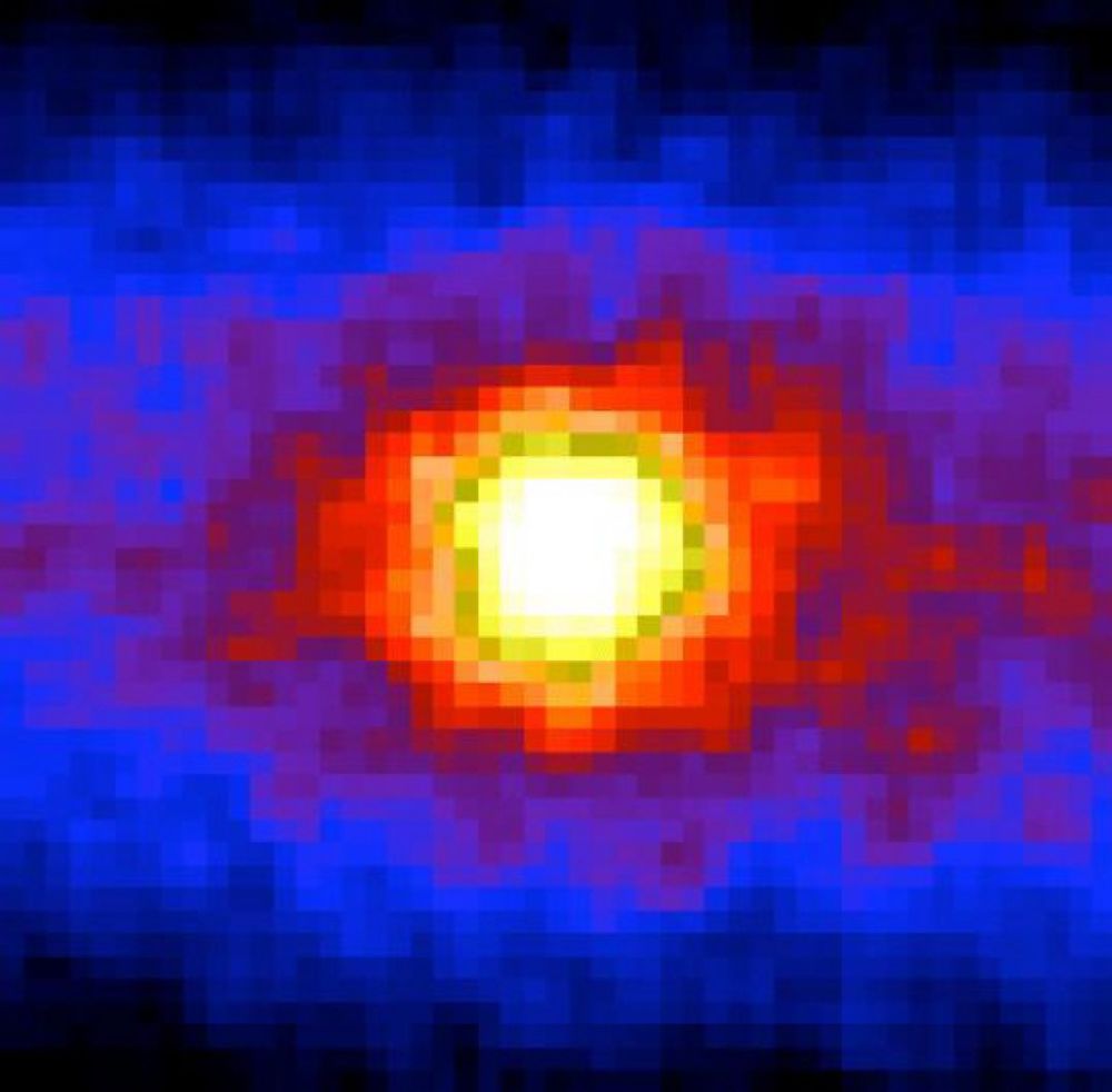
- Reposted by Jim TangThe Sun. Taken at night. Not looking up at sky but down through 8000 miles of the Earth. Not with light but neutrinos
- Reposted by Jim Tang[Not loaded yet]
- You could not script this up
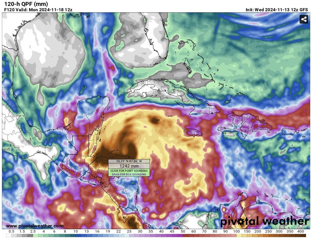
- From a net human impact perspective, the latest guidance for future TC Sara are concerning. Honduras has a rough history w/ hurricanes & the latest GFS shows a 5-day rainfall total of 1242 mm, or 48 inches, over parts of its north coast. This would have catastrophic consequences.
- Reposted by Jim Tang[Not loaded yet]
- If you read between the lines you can tell the ECMWF is investing more heavily in their ensemble and AI systems and less so on their deterministic model— something to keep in mind when considering the suite of guidance and the direction where model development is going towards
- Reposted by Jim Tang[Not loaded yet]
- Visualization of how heavily indexed the Twitter algorithm is on time locality Most other SM platforms (at least anecdotally) index on spatial locality (topics and what the people you follow engage with)
- Reposted by Jim Tang[Not loaded yet]
- Reposted by Jim Tang[Not loaded yet]
- Reposted by Jim Tang[Not loaded yet]
- Reposted by Jim Tang[Not loaded yet]
- Reposted by Jim Tang[Not loaded yet]
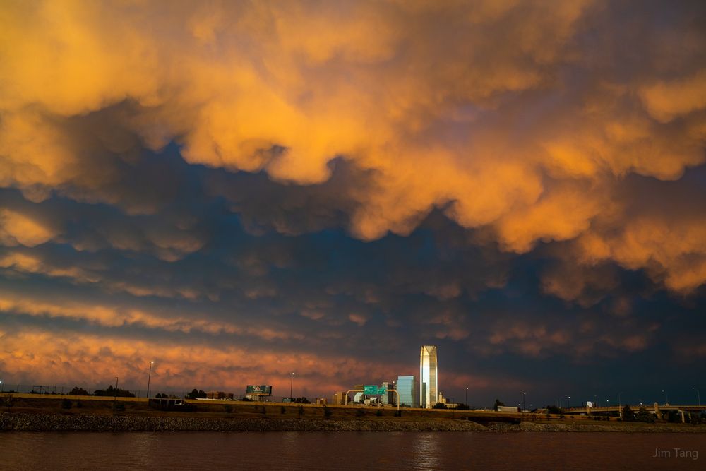
- The calm after the storm in Oklahoma City. A sunset burn for the ages.
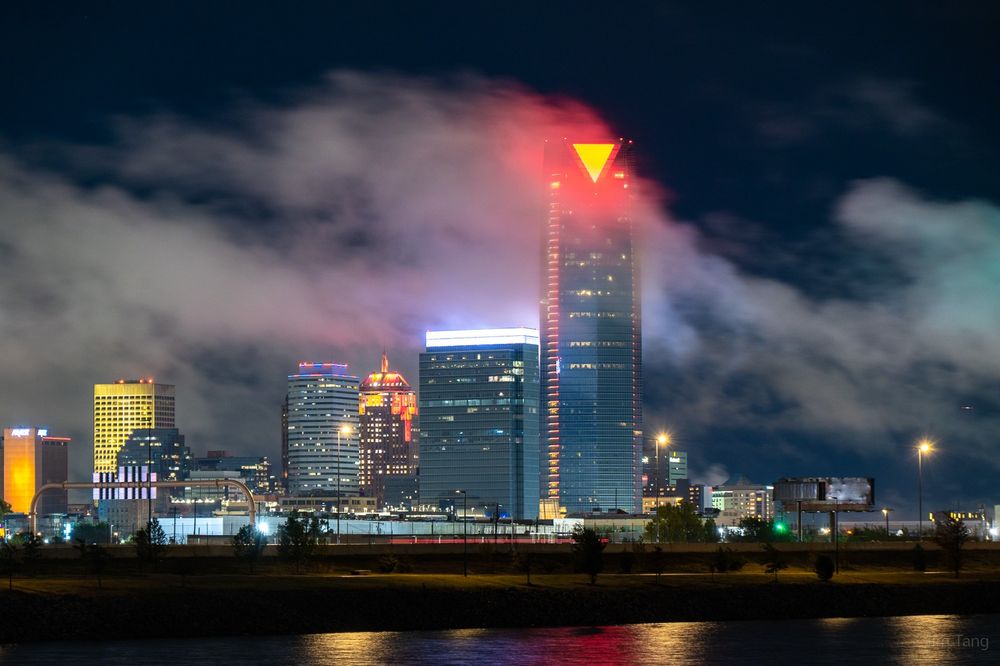
- Was scouting some new comps of the OKC skyline when LLJ clouds and occasional KH structure stole the show.
- Shower thought of the day: high-echelon tornadoes ought to be on average less rain-wrapped, because strong and tight mesocyclones are more likely to centrifuge out wrapping rain curtains before they completely cover a tornado.