Neil Lareau
Prof. of Atmos Sci. @unevadareno. Mountain WX, Wildfire Plumes, Backcountry Skiing, Frontcountry Dadding. Formerly: @SJSUmeteorology @UUtah
@Livermore_Lab @MWObs scholar.google.com/citations?user=UGaG…
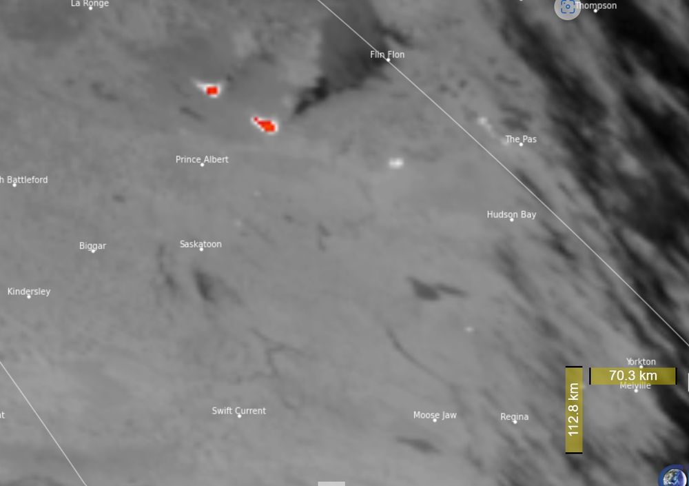
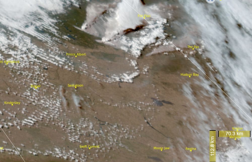
- Reposted by Neil LareauActive fires in Saskatchewan this afternoon. Mid-ir shows some very active fires (red/bright white) and a possible pyrocb (fire generated thunderstorm) in the GOES-West Geocolor.
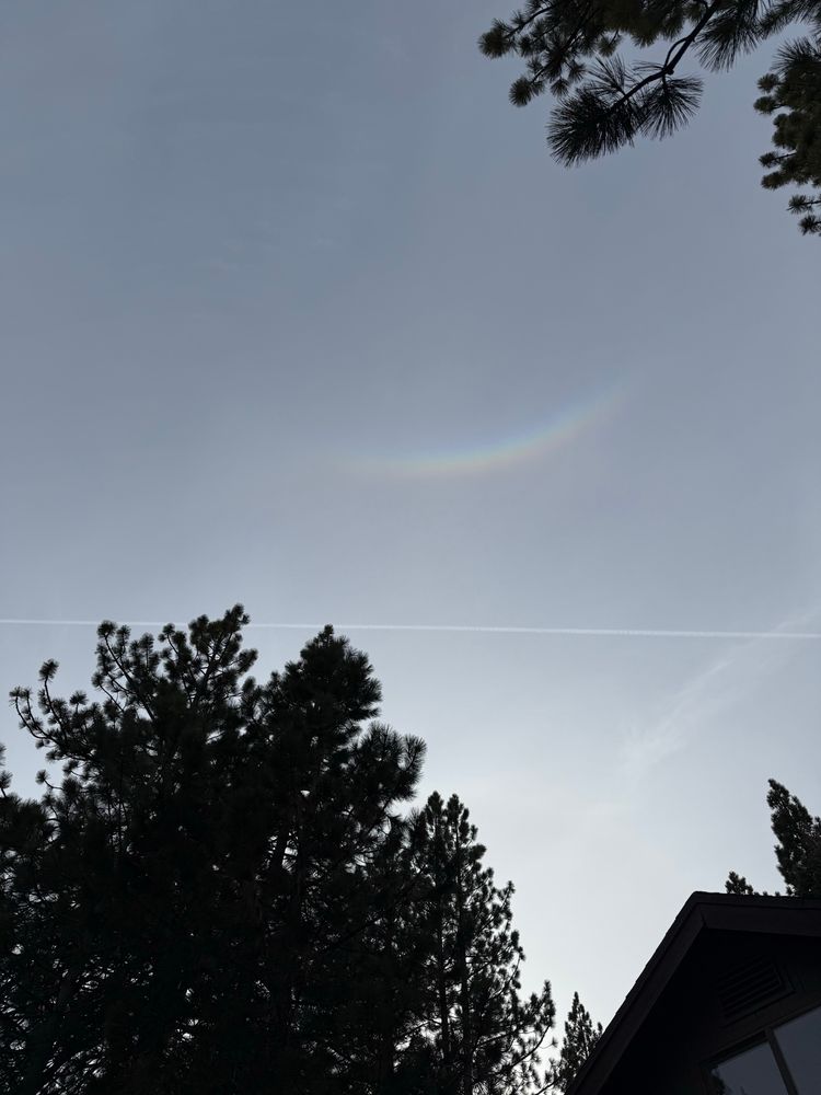
- Circumzenithal arc.
- Impressive fire activity today in New Jersey. Here is a 3D radar view of the plume structure from the #JonesFire during its peak fire intensity.
- Cool example of preferential convection initiation on the snowy-to-snow-free boundary on the west slopes of the Sierra. Note the deeper cloud formation over the heated land as opposed to the snowpack (green).
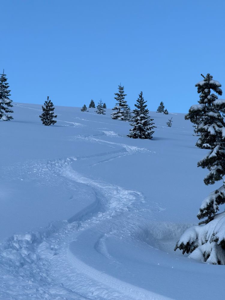
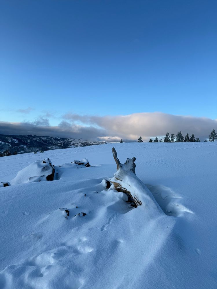
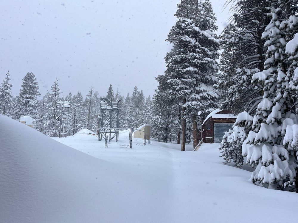
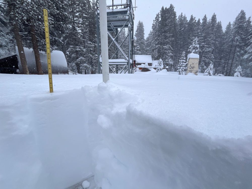
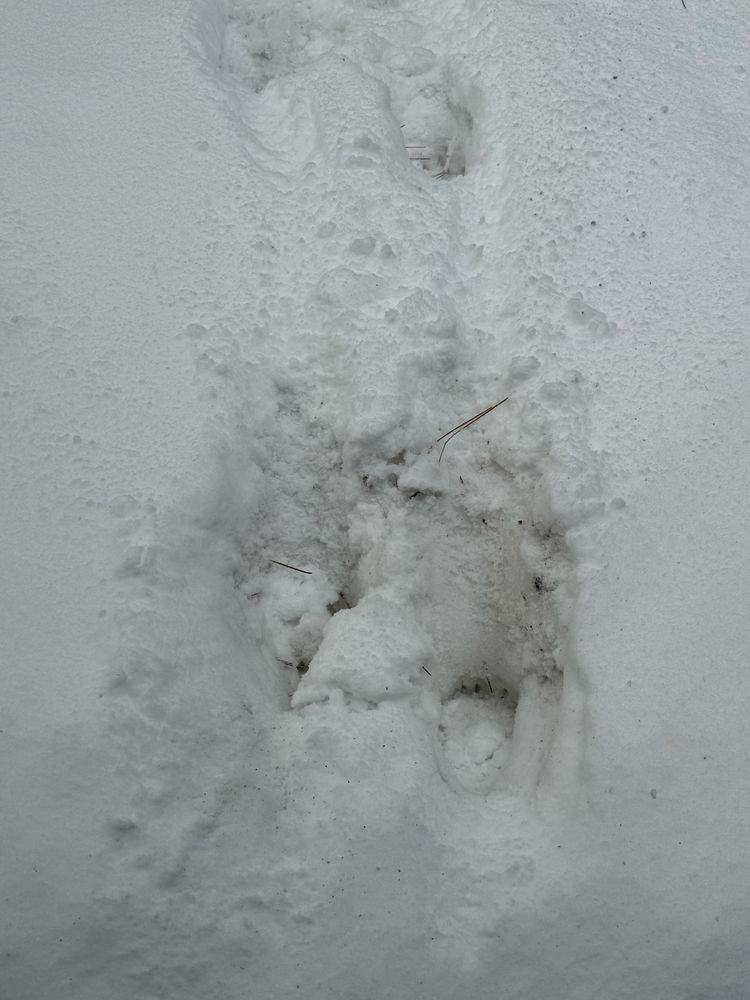
- 2+ ft of beautiful snow yesterday densified overnight, yielding excellent skiing this morning. Just wish I had more time!!
- Been an amazing day of #ShastaCountyConvergenceZone (SCCZ) activity.
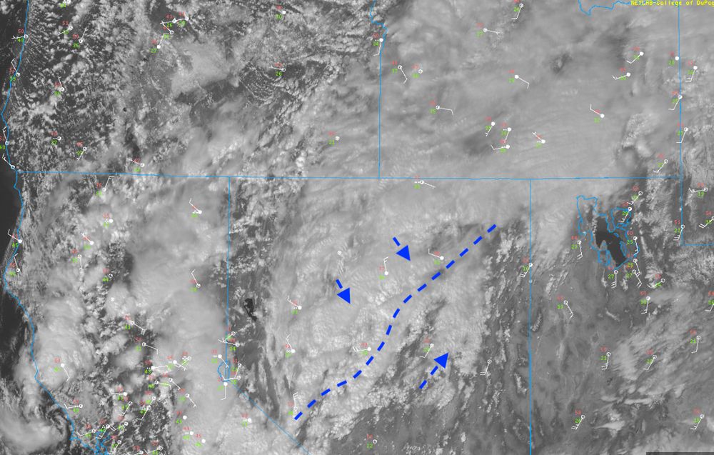
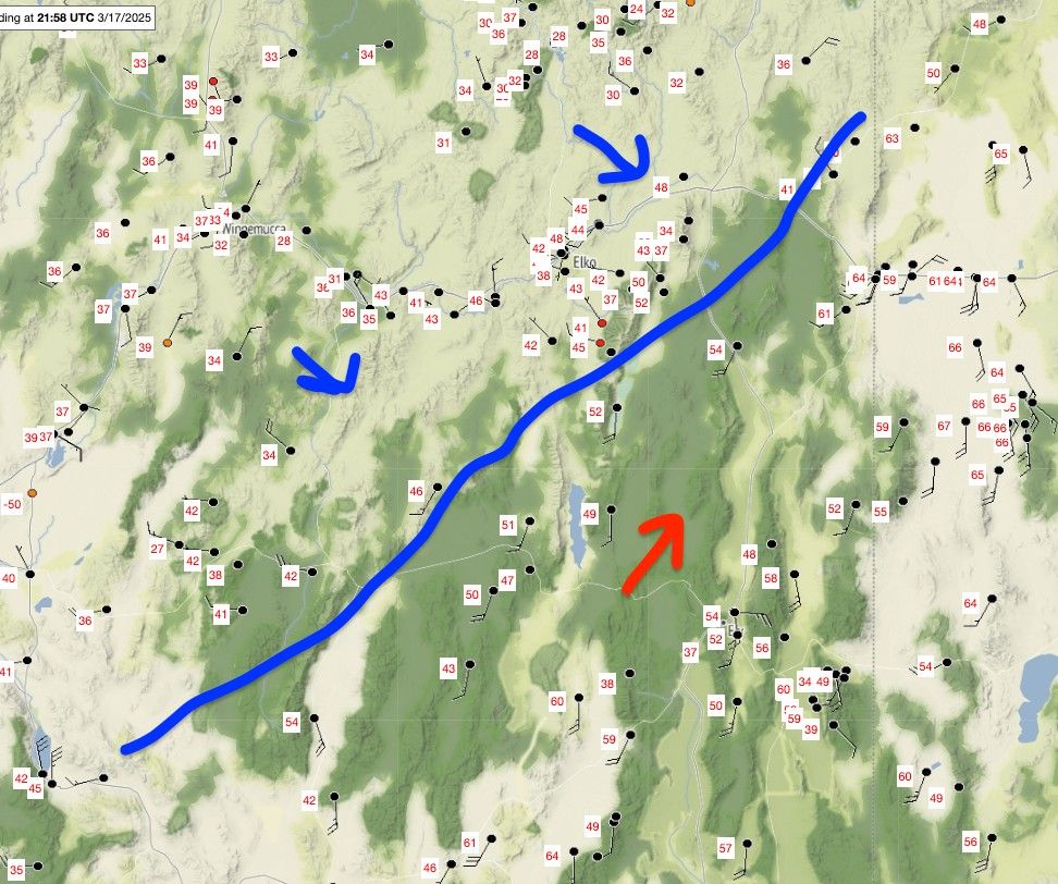
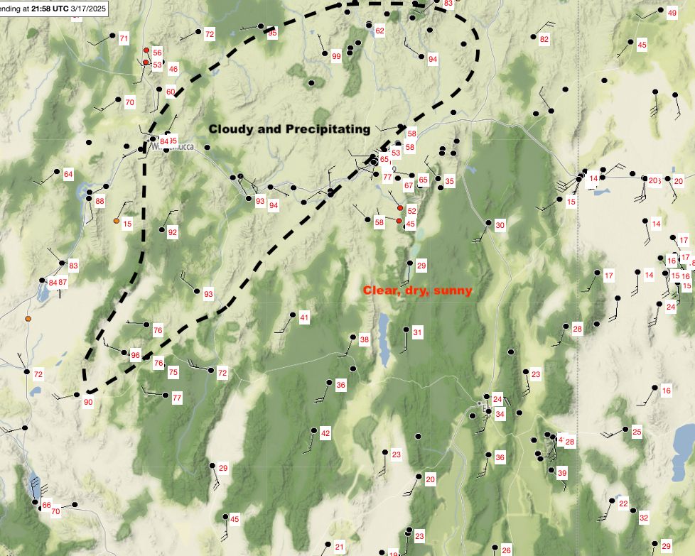
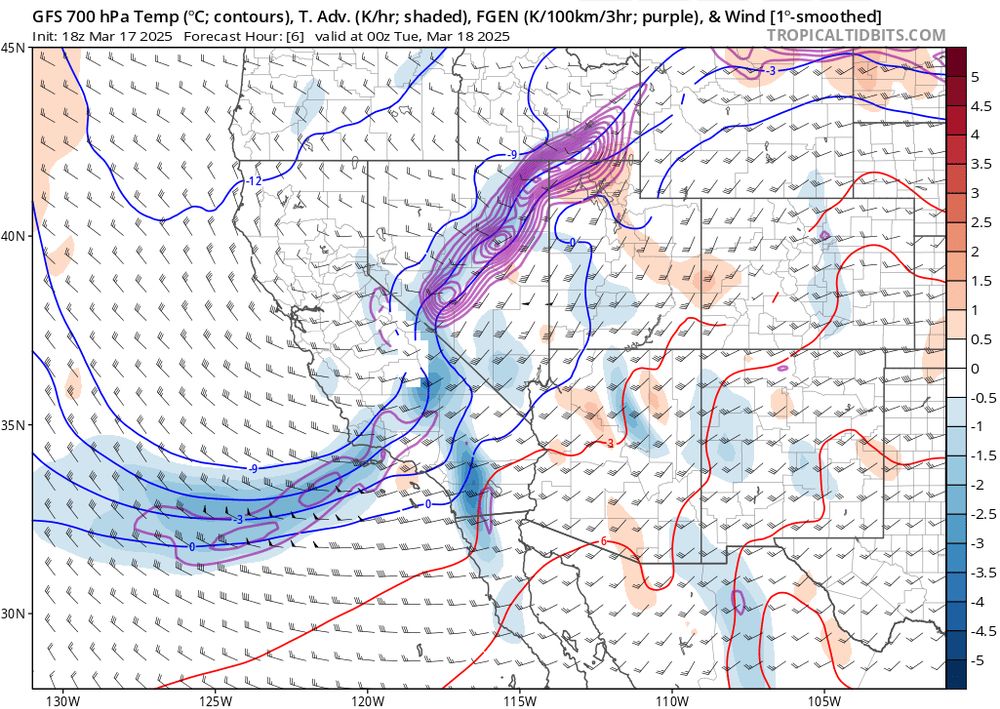
- Classic early spring inter-mountain frontogenesis today: (1) Satellite image, (2) surface temperatures and rough diagram of the confluent region, (3) cross front diabatic heating differences helping to sharpen the front, (4) frontogenesis function (purple contours) from GFS.
- Double barreled Shasta County Convergence Zone
- Fires (black dots) and plume (radar/green/blue) popping up amidst the blowing dust in Texas and Oklahoma. Could be ugly when the wind shift hits...
- Reposted by Neil Lareau3/13/2025 10am Update: We had 27" (68.5 cm) of #snow accumulation in the last 24 hours, which brings our storm total to 27.8" (70.5 cm). Light to moderate snow will deliver a few more inches today and another significant storm will move in tomorrow morning. #CAwx #CAwater
- Reposted by Neil LareauCosts of child care now outpace college tuition in 38 states, analysis finds missouriindependent.com/briefs/costs...
- Reposted by Neil LareauCome join our growing wildfire fire team at TRU. We are hiring a new assistant/associate fire professor in Arts & Tourism. Closes 26 March 2025 tru.hua.hrsmart.com/hr/ats/Posti...
- Reposted by Neil LareauSCOOP: 2 NWS Bay Area employees were fired today. They were on their probationary period: A meteorologist & an administrative support assistant. "We already have a number of vacancies, so this will affect us in running 24-hr shifts." Dalton Behringer, the office's union steward @kqednews.kqed.org
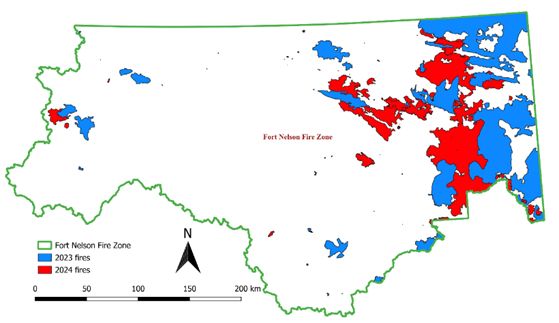
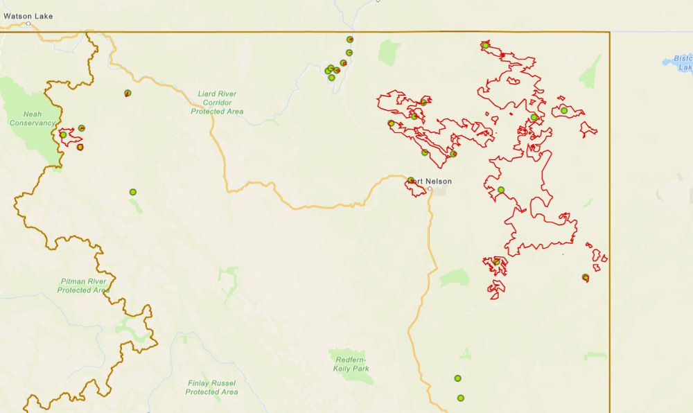
- Reposted by Neil LareauIn 2024 a significant portion of BC area burned was due to 2023 fires that survived the winter (see figure on the left side). The current fire situation is on the right side wildfiresituation.nrs.gov.bc.ca/map and some are 2023 fires. First time I have seen fires survive two winters in Canada.
- Out and about
- Reposted by Neil LareauI'm a reporter at the SF Chronicle hoping to speak with scientists who were impacted by the government firings. Specifically NOAA scientists, especially those in California. Open to hearing from you on the record, off the record or anonymously. email: anthony.edwards@sfchronicle.com DMs open
- Reposted by Neil LareauDebris basins quickly filling up in the foothills of the Eaton burn scar. Here’s Sierra Madre Canyon. #CAwx
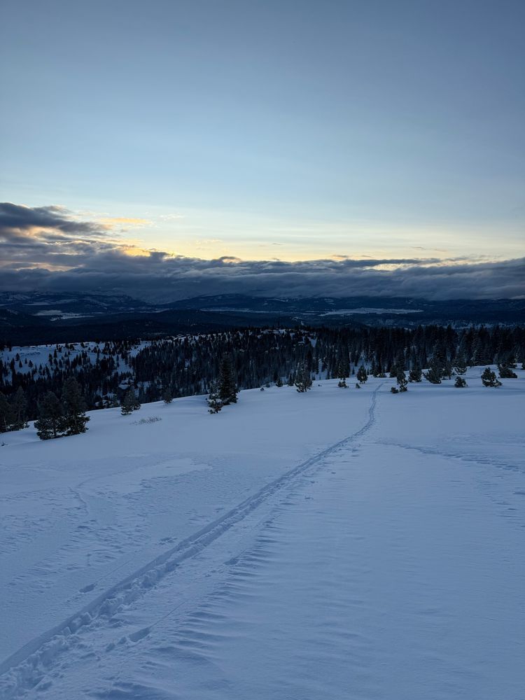
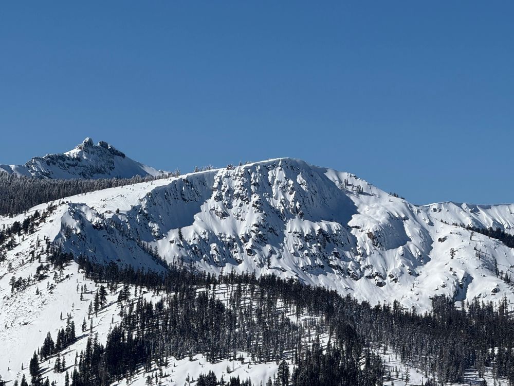
- Sierra crest looking mighty fine today. (Frog Lake cliffs and Castle Peak)
- Resetting the brain chemistry.
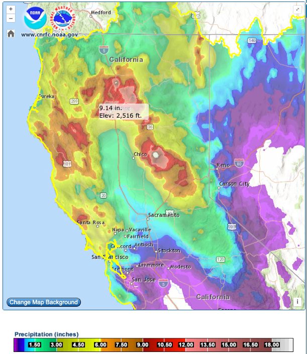
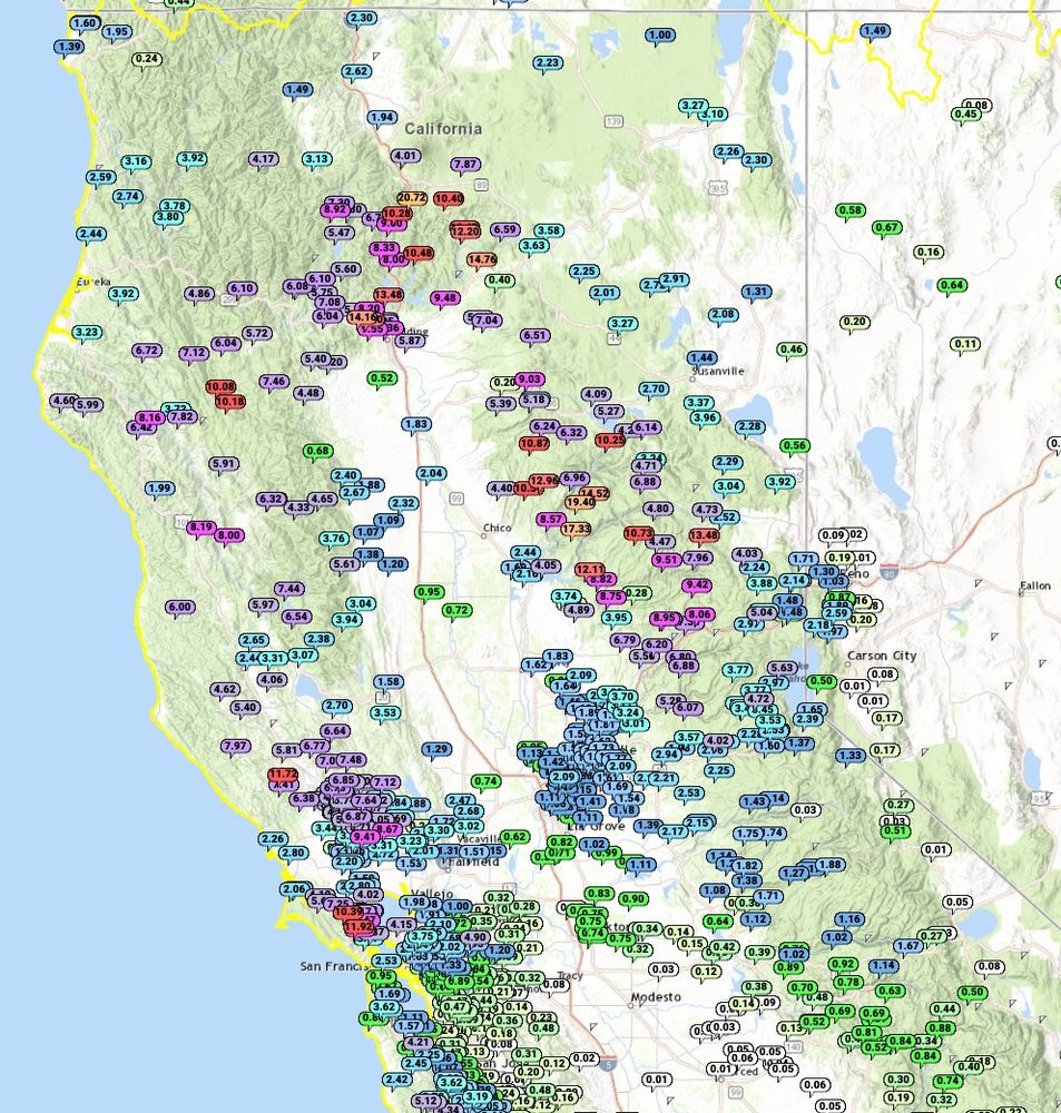
- Impressive 72-hr precip totals across NorCal, including the always-consistent climatological maxima near Oroville (>19"). Seems like a good spot for a reservoir, eh?
- Reposted by Neil LareauNote the wind ripping along that boundary (wind mode below) to severe thunderstorm warning levels approaching 2pm. Expecting strong gusts into San Francisco and down the peninsula in the next 30 minutes. #CAwx 2/4/2024
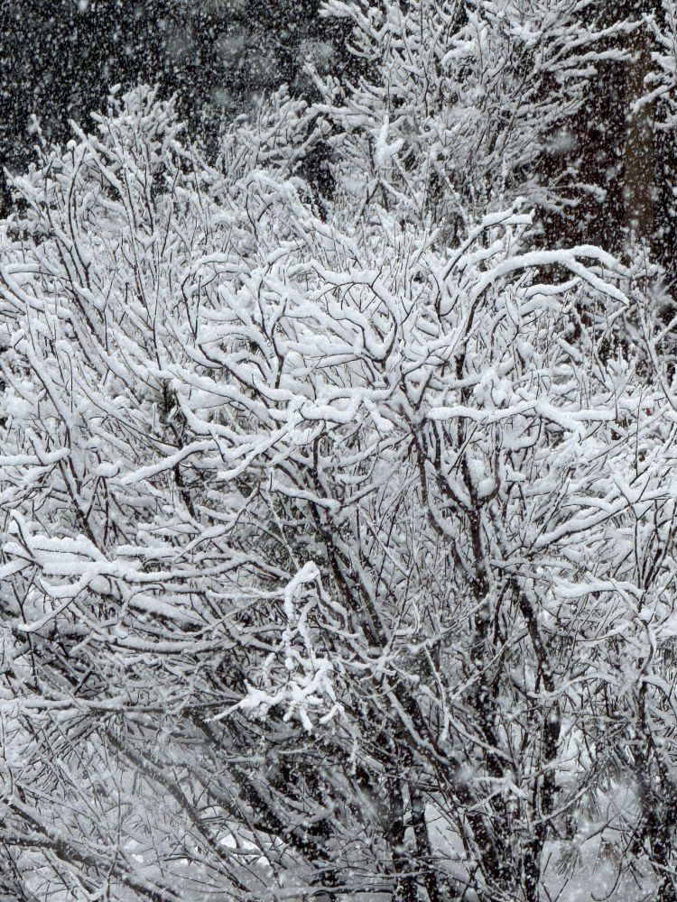
- Finally: Large aggregates falling in #Truckee today. I much prefer frozen precipitation. Been a tough stretch of heavy rain, so great to see the landscape painted white.
- Stunning example of the "Shasta county convergence zone", apparent as the stationary linear convective feature embedded within the broader AR #sccz
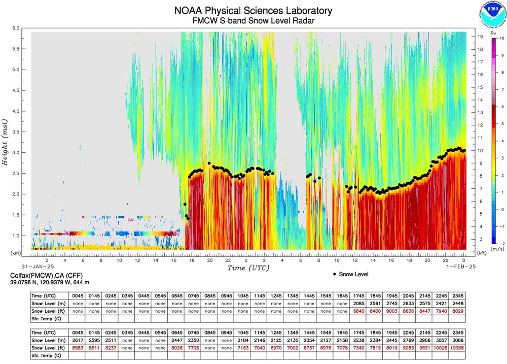
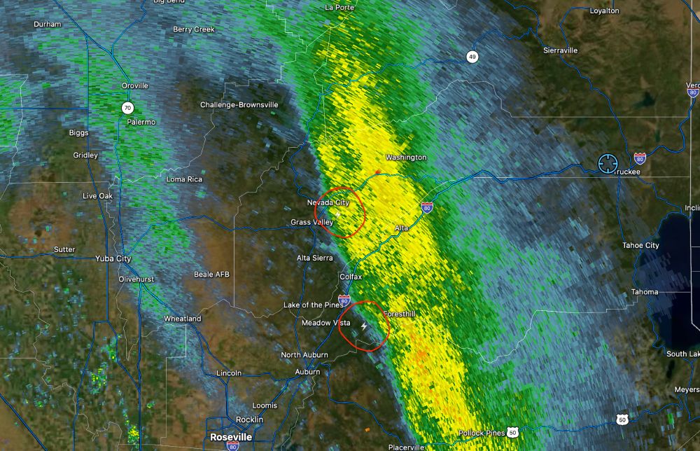
- Gotta love those 10Kft snow levels (measured west of the Sierra Crest in Colfax)... Sooo much rain in #Truckee today. Granted looks like still mostly snow at 8500+ft over on @MtRoseSkiTahoe, suggesting locally lower snow levels over the peaks.
- Curious if anyone can provide context with how similar/dfferent this is than what occurred in 2017. I recall DOE grants being paused and reviewed for alignedment with executive priorities at the time… www.nytimes.com/live/2025/01...
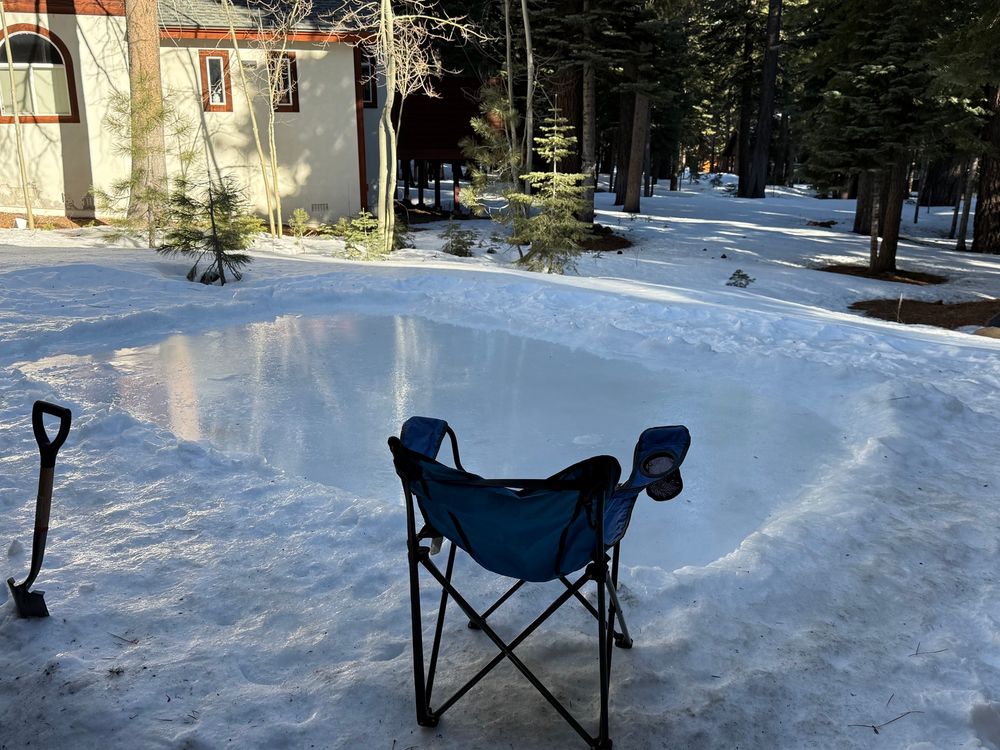
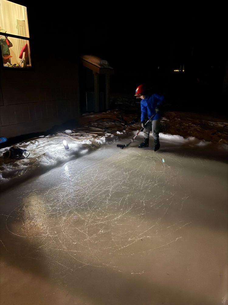
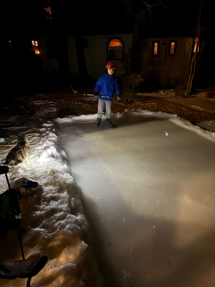
- I’ve given up on new snow and moved on to a mini yard rink. I’d prefer not to say just how long it took to get this small patch… way longer than reasonable!
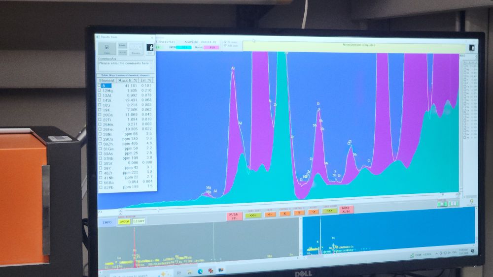
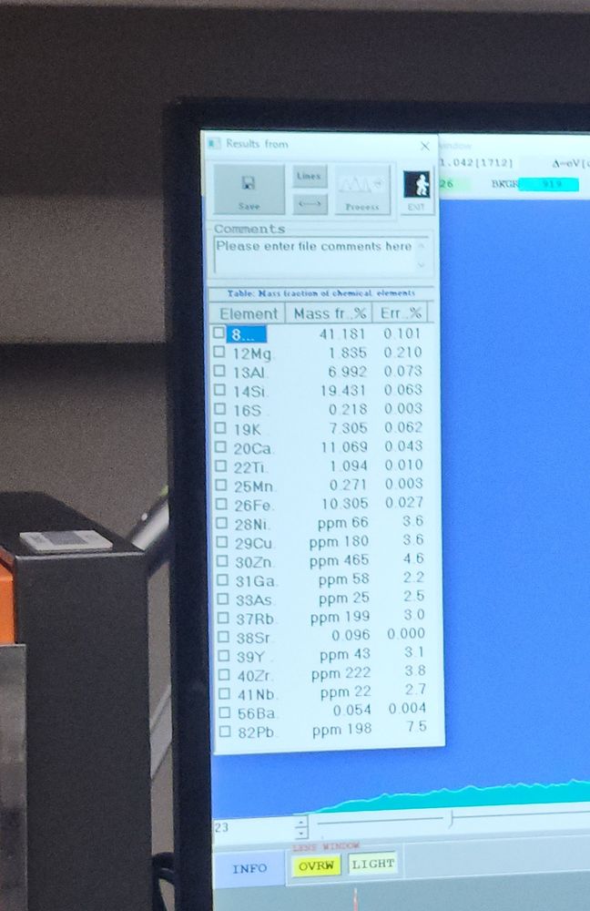
- Reposted by Neil LareauJust had a sample of the Eaton Fire ash that is in my driveway run on the department XRF. Is there titanium (new house paint)? Yup. Lead (old house paint)? You betcha. Heavy metals? Check. Treat that ash like it's toxic folks (because it is)
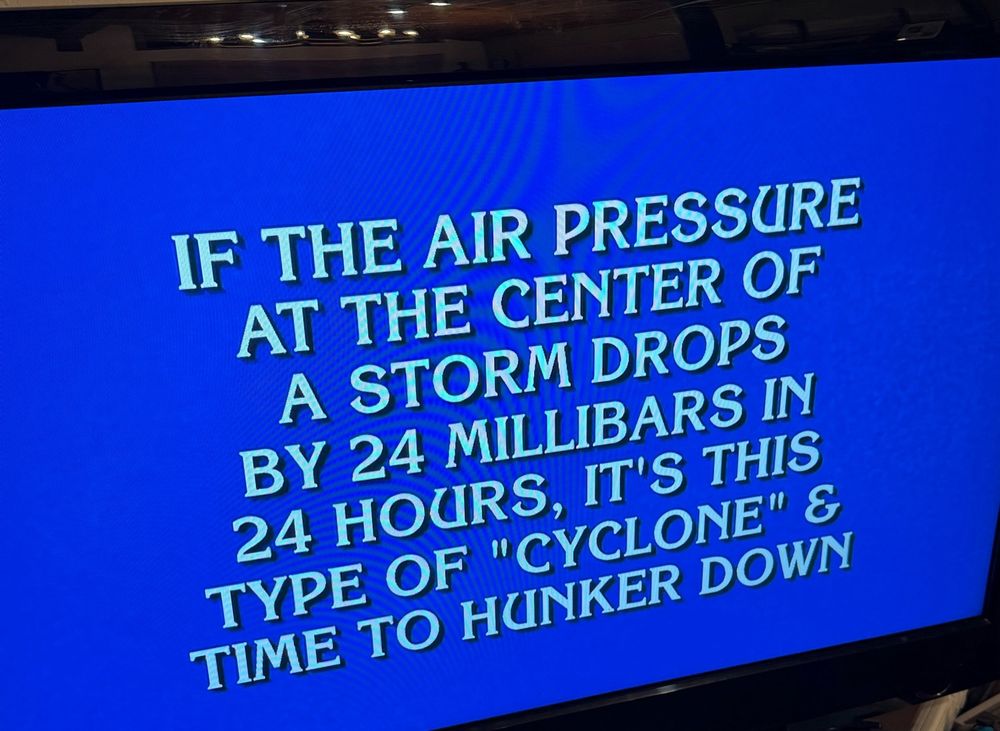
- Great jeopardy question tonight! An even better question… what is the name of the associated unit of measure?
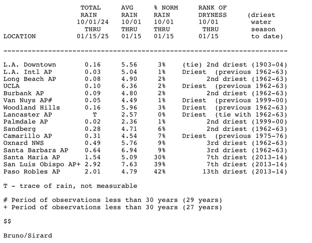
- Reposted by Neil LareauThere’s drier than average and there’s what’s ongoing in SoCal since last year. The last day with at least 0.10” rain in Downtown LA was on May 5th, 255 days ago per @NWSLosAngeles @NBCLA #FireWx #CAwx 1/17/2025
- Two very different landscapes. NV->LA. #AMS2025
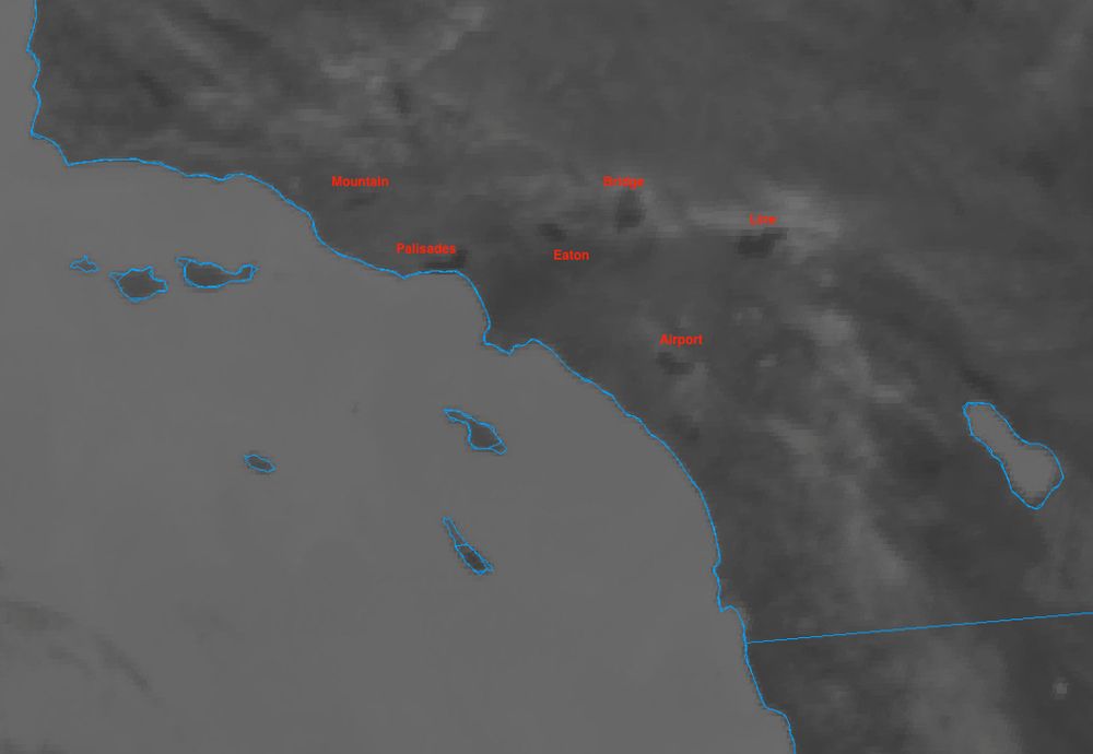
- Was glancing at the Shortwave IR to check for any new heat signatures and noticed that you can clearly see all of 2024/2025's fire scars around the LA basin, including the non-Santa Ana fires like the Bridge and Line fires. The "heat" here is simply the land being hotter due to less vegetation.
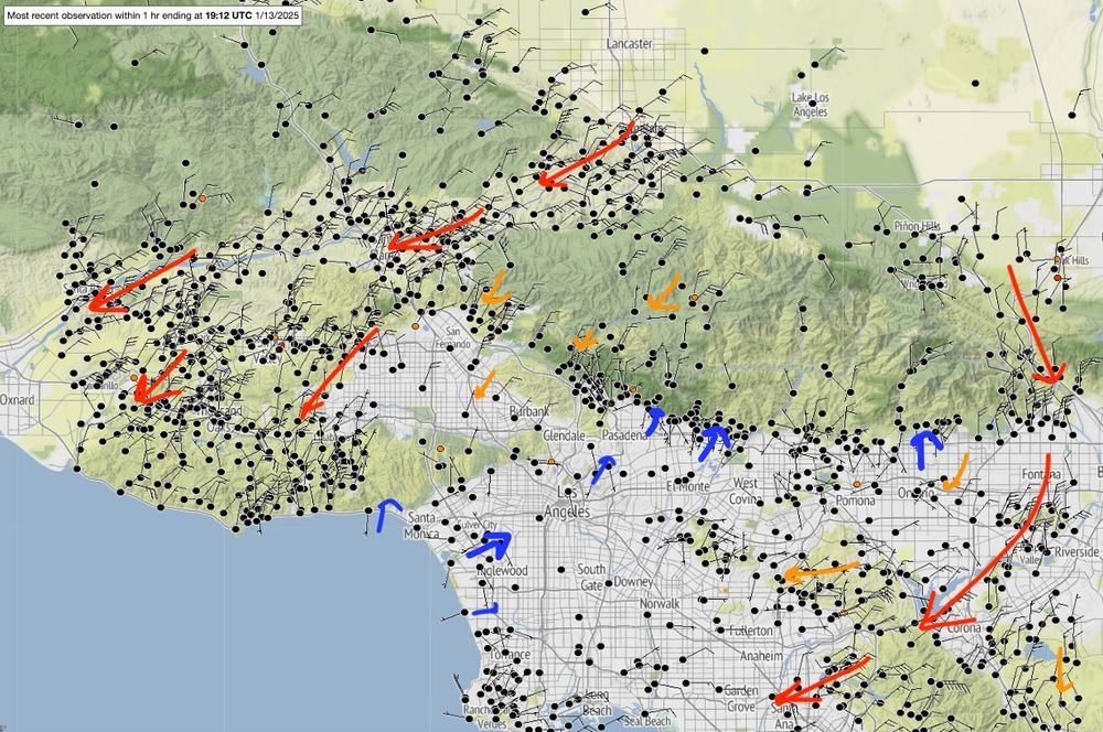
- Typical Santa Ana wind regimes today, with favored gap flow locations exhibiting strong ENE winds, while areas around Pasadena (#EatonFire) remain sheltered with weak westerly flow.
- Finally. A powder day.
- Beautiful example of the "Shasta County Convergence Zone" generating embedded linear convection, then progressing to an isolated band. #SCCZ
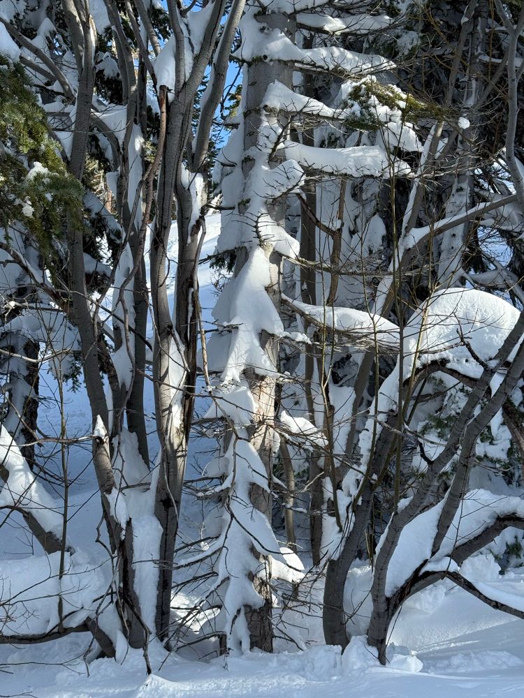
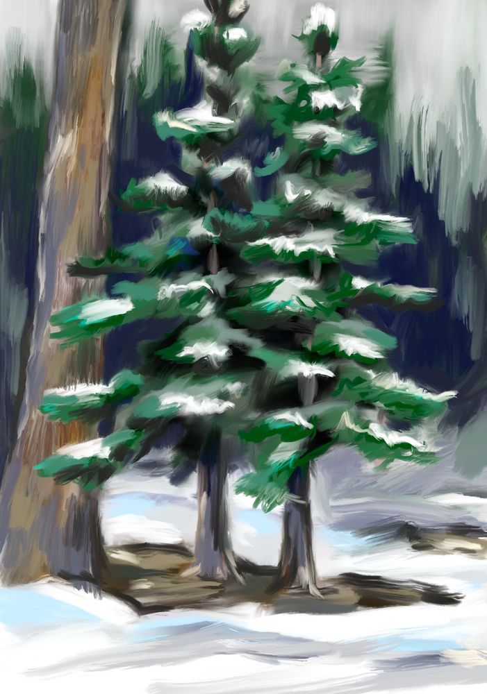
- Winter tree sketch
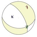
- Axial tilt, the reason for the season!
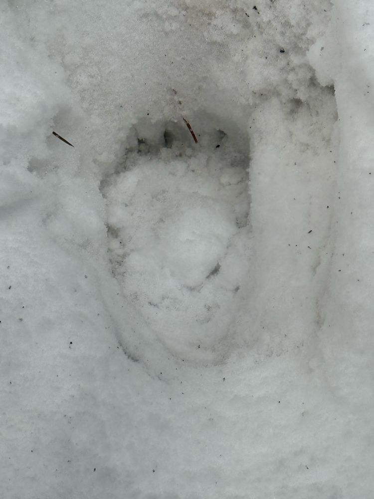
- Unexpected Xmas visitors: 2 bear cubs tried to make off with our grill last night. Hauled the grill and propane tank down the walk before I scared them off. They were after the grease..
- After days of rain and warm temps, we’re getting a nice new coat of white just in time for Christmas!
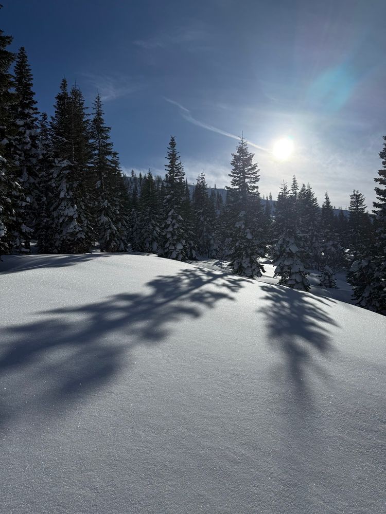
- Earlier today in Truckee
- Reposted by Neil Lareau
- Rapidly deepening cyclone delivers a direct hit for the Bay Area, with strong winds, thunder and lightning, and torrential rains. Significant Sierra snowfalls as well. What a storm! #CAwx
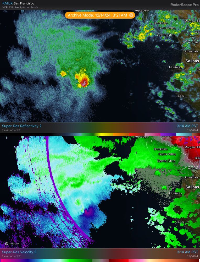
- Quite the cyclonic cell entering Monterey bay @ 3:30 AM!!
- Beauty of a narrow cold-frontal rain band (NCFR) sitting offshore along the north coast this afternoon.
- Was not expecting lightning along the warm front aloft today! A few strikes along the Sierra's western slopes as the stratiform precipitation band really intensified (kinda similar to east coast banded snow storms producing lightning).
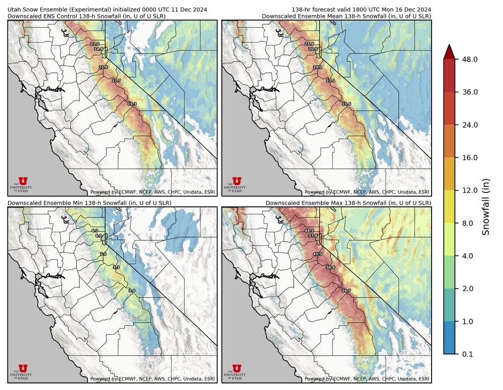
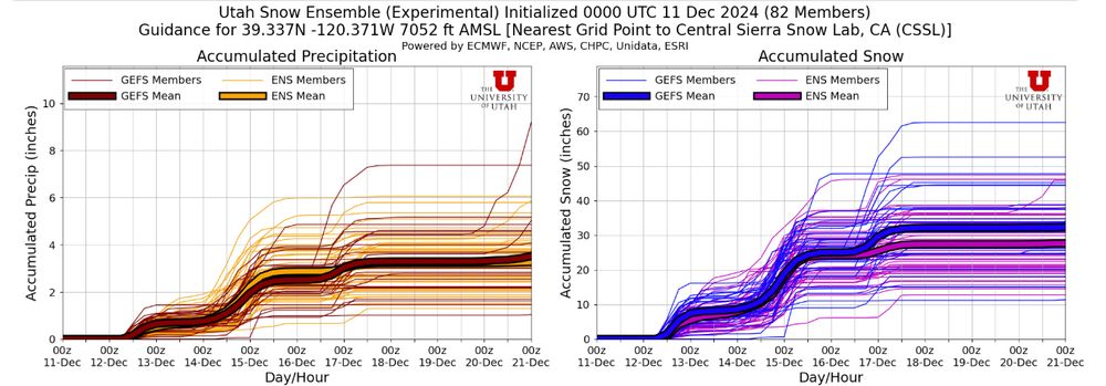
- Having a look at the U-of-U snow ensemble for Thursday and Saturday's systems. Ensemble mean is around 25" at the Central Sierra Snow lab (just west of the Sierra Crest).
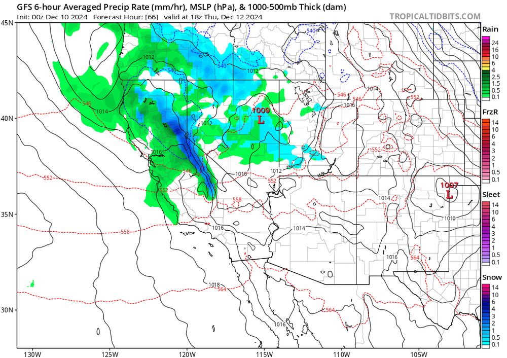
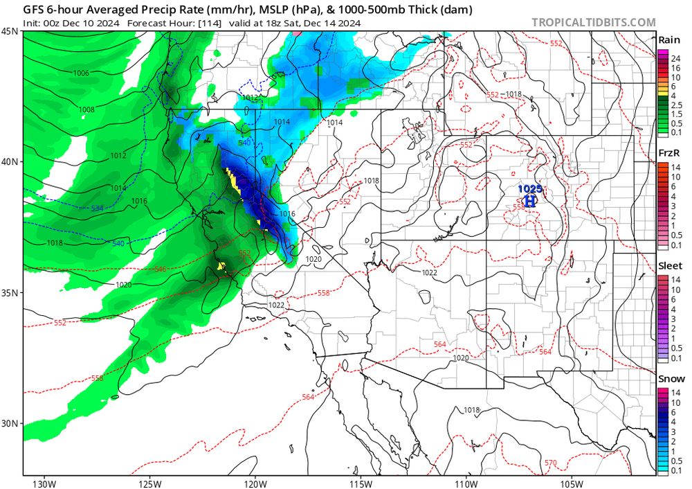
- Excited for a potential 1-2 punch of vigorous systems moving across the Sierra Thurs (left image) and Saturday (right image). Still quite a bit of variability in the Saturday model spread, but I particularly like today's 00z run (wishcasting a bit, eh?).
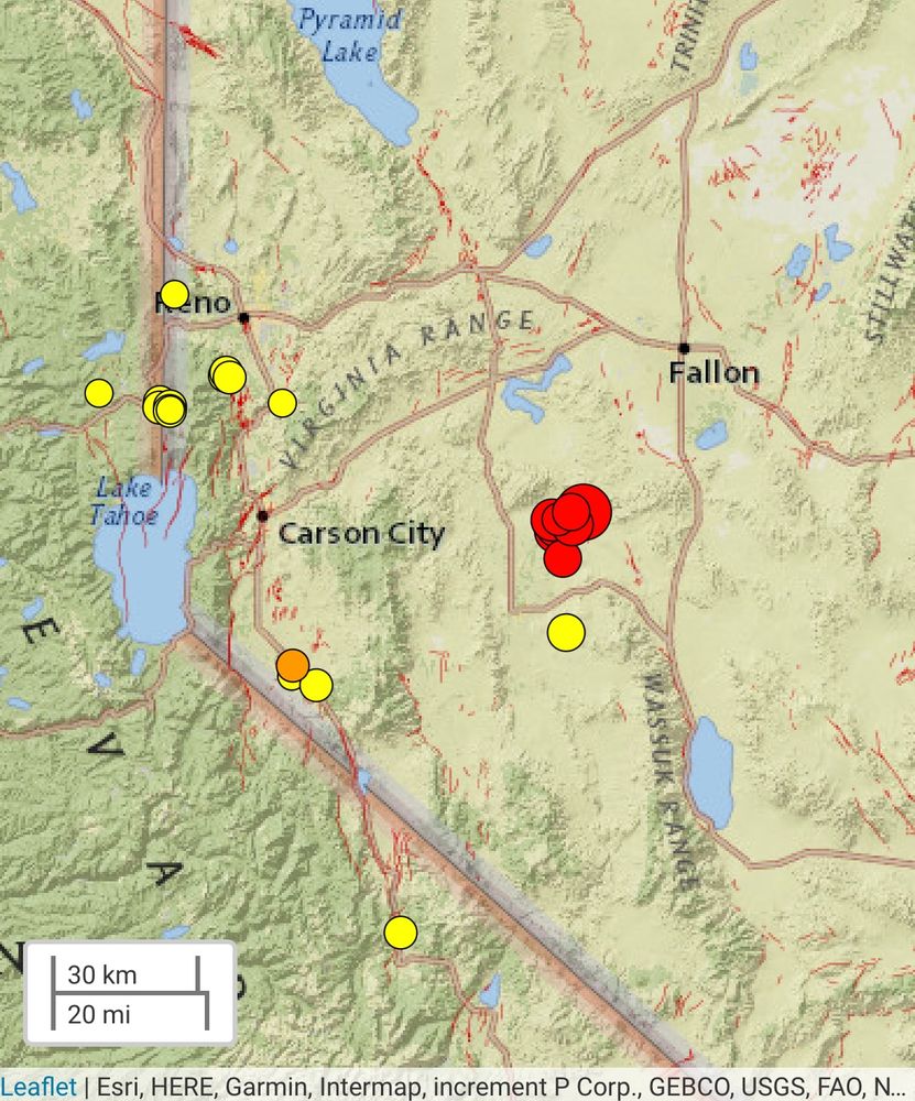
- Got the shake alert for this one in #Truckee. 4th grader did the full drop and cover routine at school. I was outside and didn't feel it.
- M5.5 #earthquake east of Lake Tahoe, shallow strike slip faulting. Quite a few aftershocks already recorded. 🧪⚒️
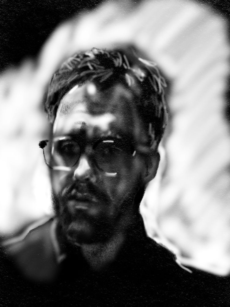
- Self portrait: scientist on a zoom call. iPad art....