Neil Lareau
Prof. of Atmos Sci. @unevadareno. Mountain WX, Wildfire Plumes, Backcountry Skiing, Frontcountry Dadding. Formerly: @SJSUmeteorology @UUtah
@Livermore_Lab @MWObs scholar.google.com/citations?user=UGaG…
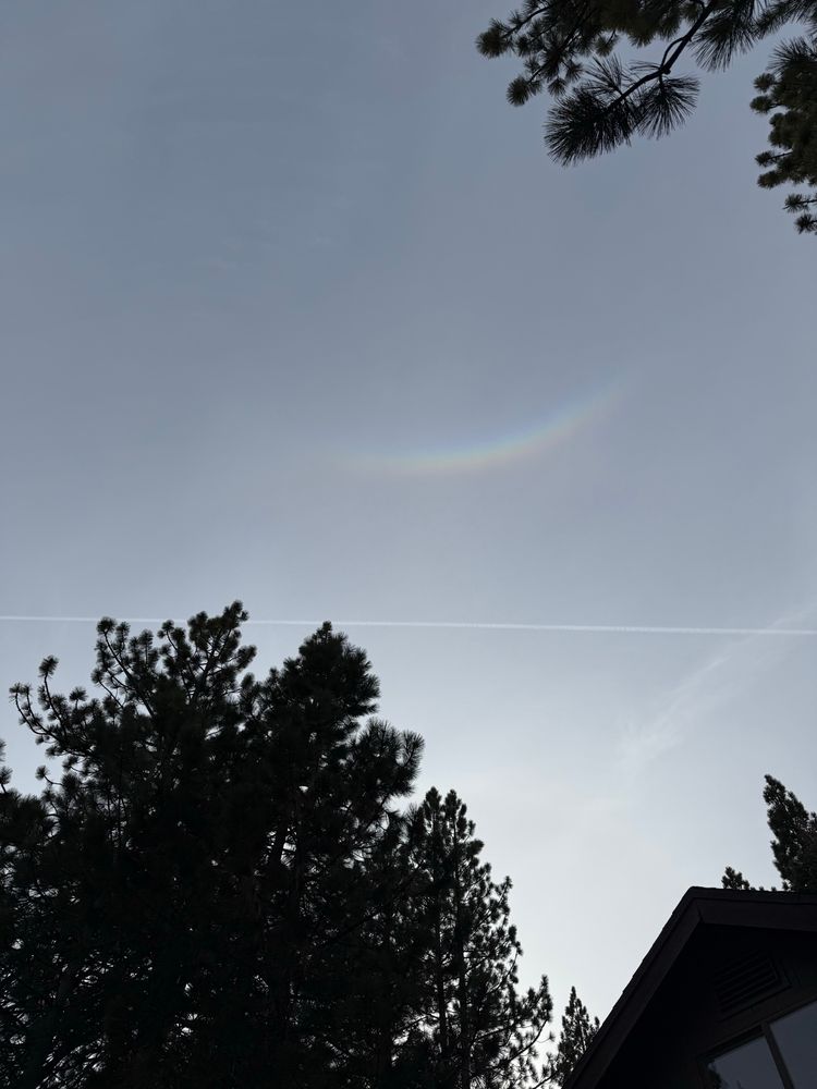
- Circumzenithal arc.
- Impressive fire activity today in New Jersey. Here is a 3D radar view of the plume structure from the #JonesFire during its peak fire intensity.
- Cool example of preferential convection initiation on the snowy-to-snow-free boundary on the west slopes of the Sierra. Note the deeper cloud formation over the heated land as opposed to the snowpack (green).
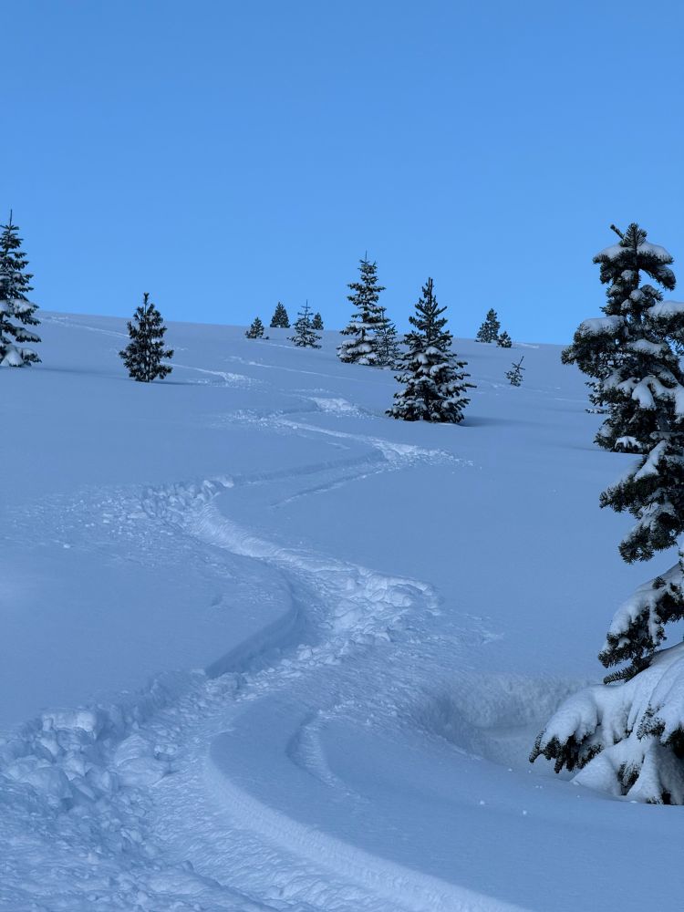
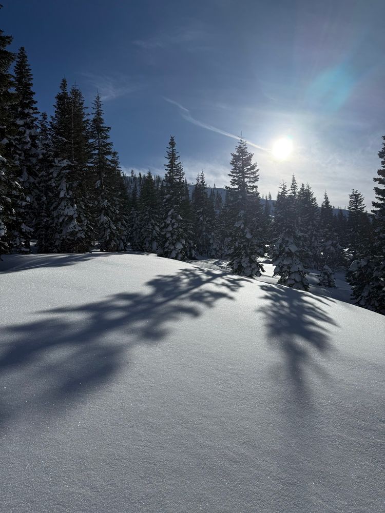
- 2+ ft of beautiful snow yesterday densified overnight, yielding excellent skiing this morning. Just wish I had more time!!
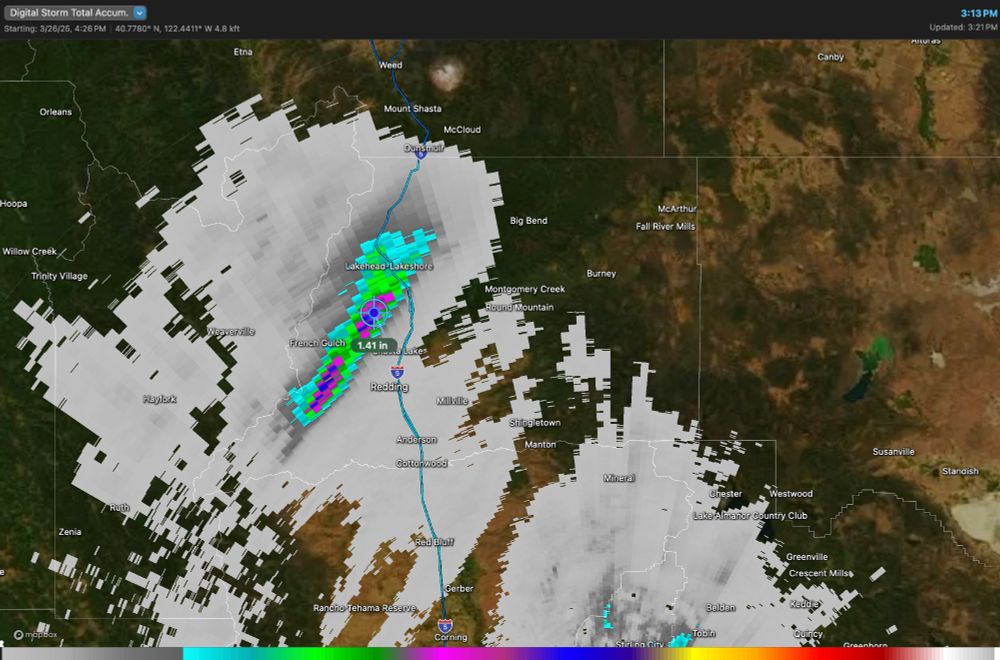
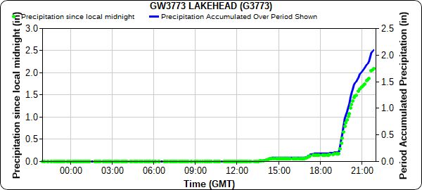
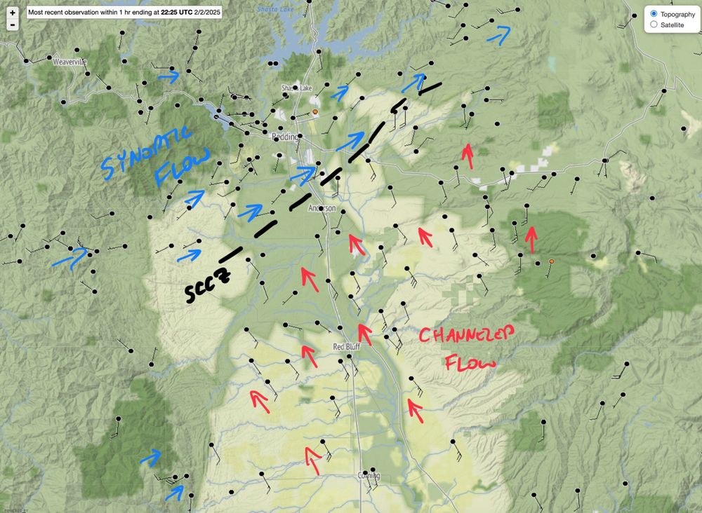
- Been an amazing day of #ShastaCountyConvergenceZone (SCCZ) activity.
- With appreciable storm total accumulations:
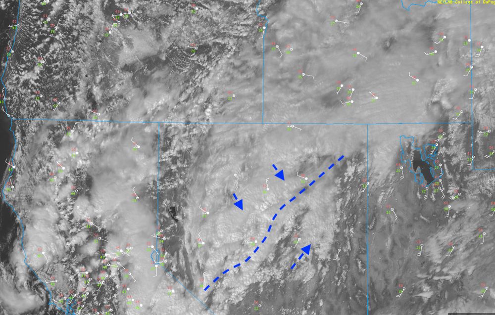
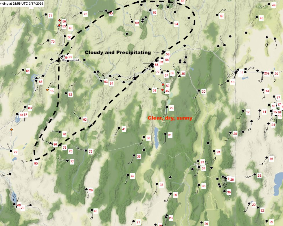
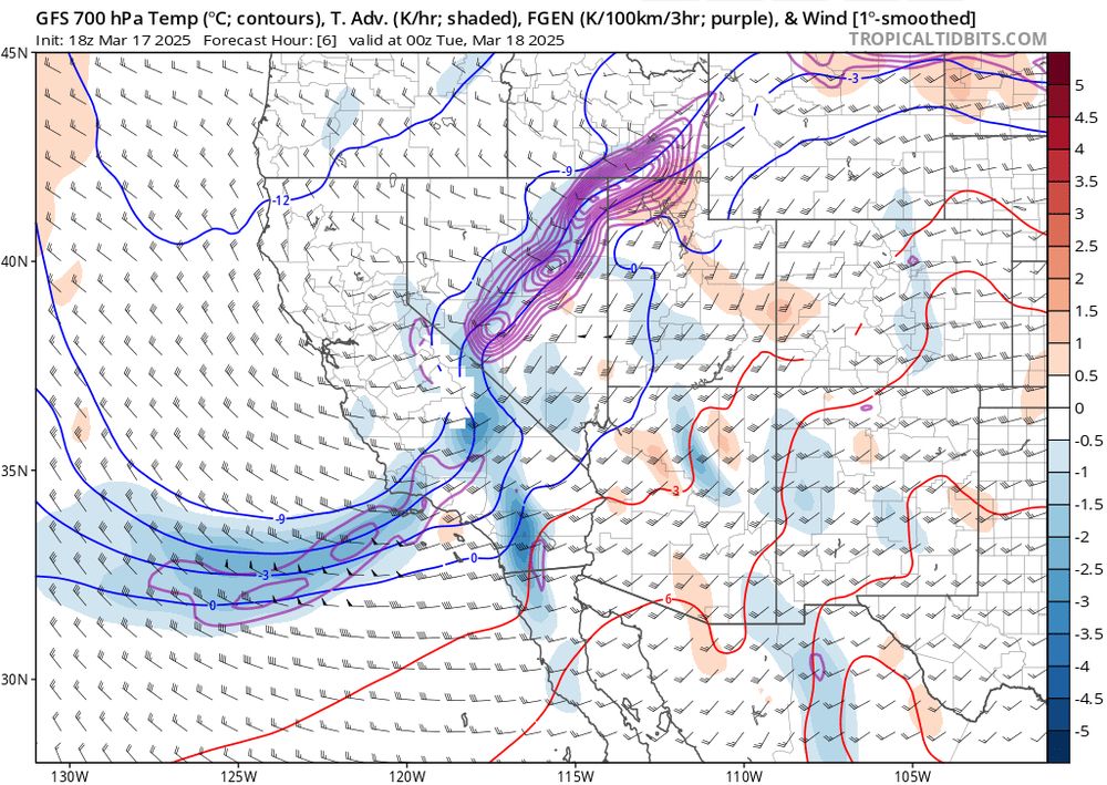
- Classic early spring inter-mountain frontogenesis today: (1) Satellite image, (2) surface temperatures and rough diagram of the confluent region, (3) cross front diabatic heating differences helping to sharpen the front, (4) frontogenesis function (purple contours) from GFS.
- Should clarify the third panel is the surface RH, such that the regions with high RH help locate the cloudy and rainy locations.
- Double barreled Shasta County Convergence Zone
- Fires (black dots) and plume (radar/green/blue) popping up amidst the blowing dust in Texas and Oklahoma. Could be ugly when the wind shift hits...
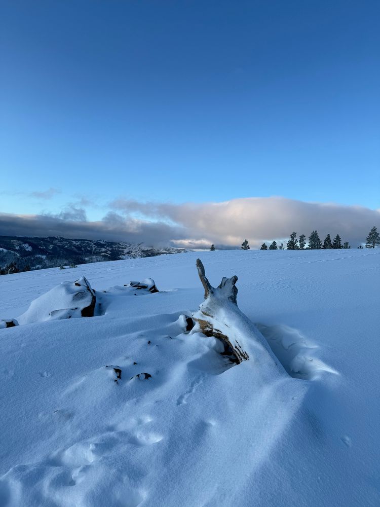
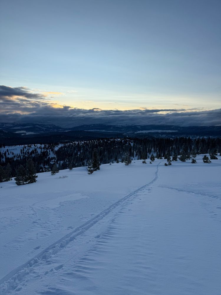
- Out and about
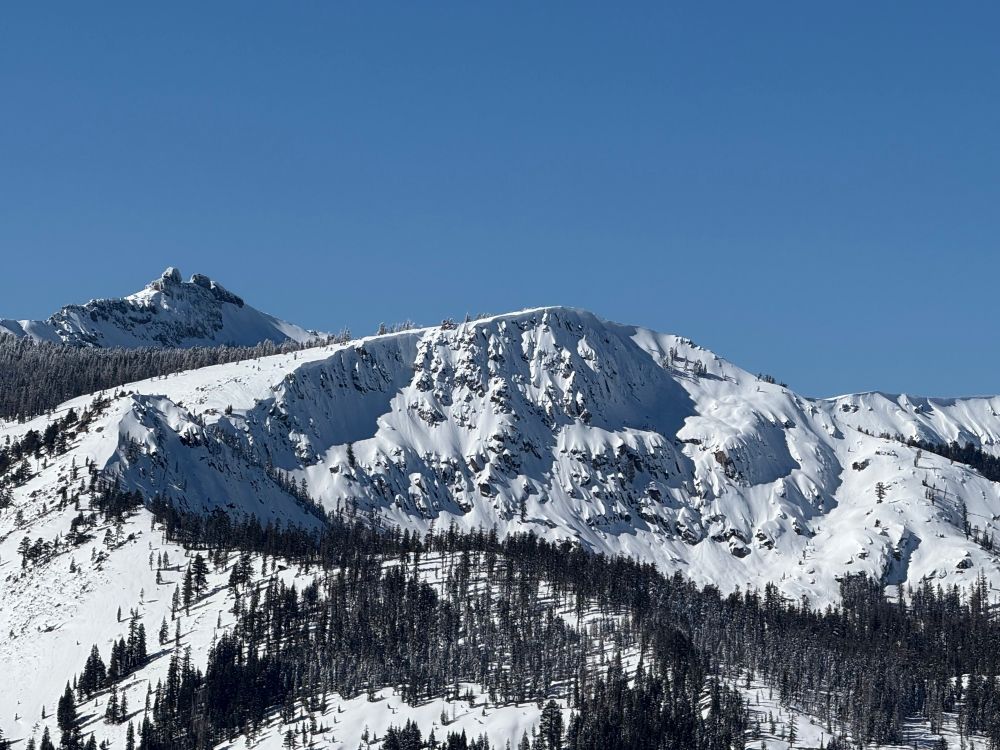
- Sierra crest looking mighty fine today. (Frog Lake cliffs and Castle Peak)
- Resetting the brain chemistry.
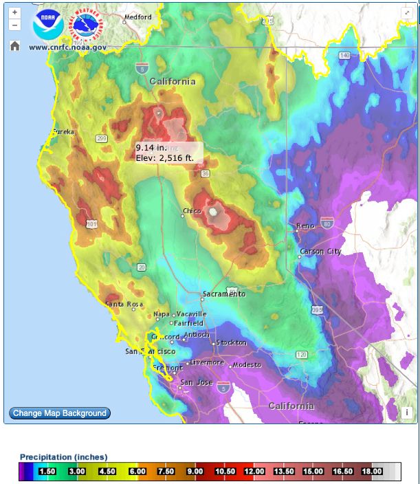
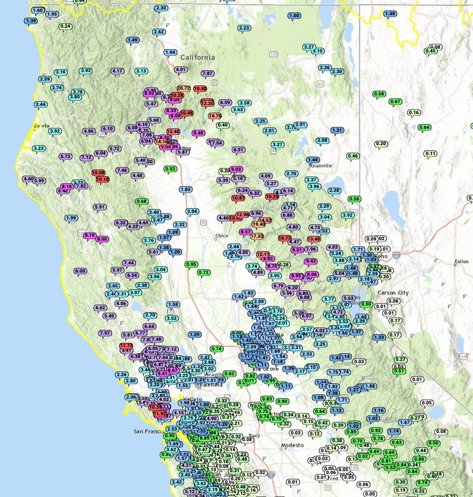
- Impressive 72-hr precip totals across NorCal, including the always-consistent climatological maxima near Oroville (>19"). Seems like a good spot for a reservoir, eh?
- Finally: Large aggregates falling in #Truckee today. I much prefer frozen precipitation. Been a tough stretch of heavy rain, so great to see the landscape painted white.
- also blue sky's video/gif support remains subpar... still a reason I'm not exclusively here... animated gifs in particular help me communicate my science...
- Stunning example of the "Shasta county convergence zone", apparent as the stationary linear convective feature embedded within the broader AR #sccz
- [Not loaded yet]
- Had a student do a thesis on this: scholarworks.sjsu.edu/cgi/viewcont...
- [Not loaded yet]
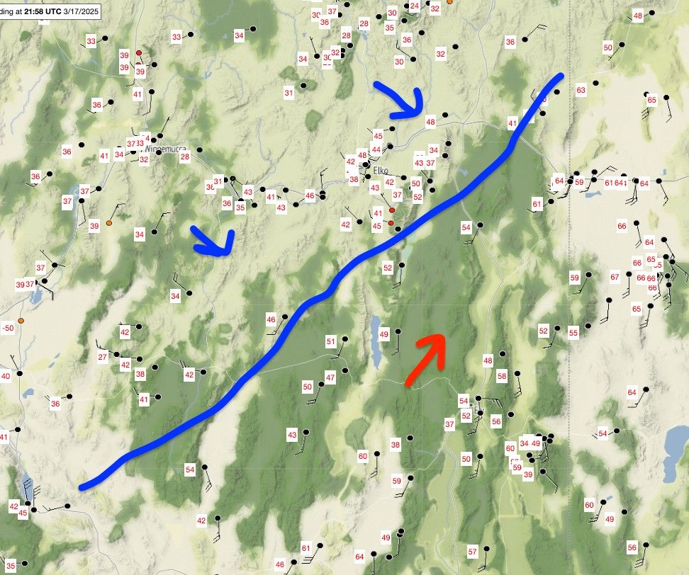
- Yes, but sort of indirectly. The development of the Sierra Barrier jet due to flow blocking along the Sierra causes a north-to-south flow along the axis of the northern Sacramento Valley. That flow converges with the "background" southwesterly wind that would exist if there mountains weren't there.
- Here is the corresponding surface weather analysis
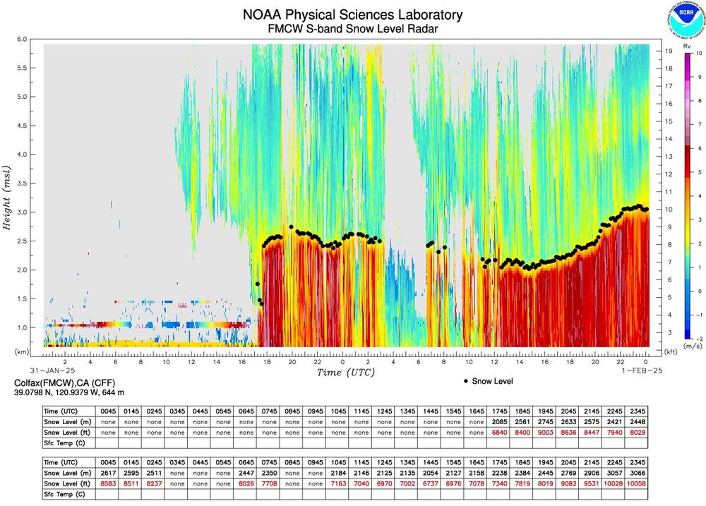
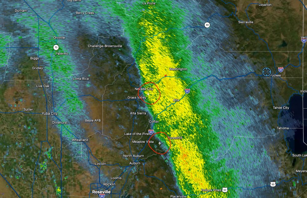
- Gotta love those 10Kft snow levels (measured west of the Sierra Crest in Colfax)... Sooo much rain in #Truckee today. Granted looks like still mostly snow at 8500+ft over on @MtRoseSkiTahoe, suggesting locally lower snow levels over the peaks.
- [Not loaded yet]
- No pictures, but I saw both a golden and bald eagle on my drive home from work today.
- Curious if anyone can provide context with how similar/dfferent this is than what occurred in 2017. I recall DOE grants being paused and reviewed for alignedment with executive priorities at the time… www.nytimes.com/live/2025/01...
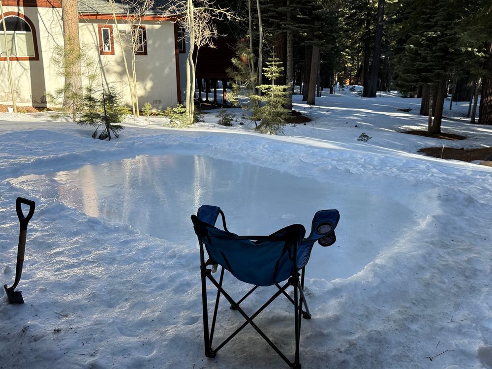
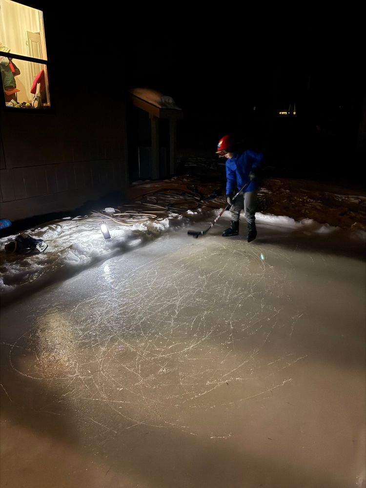
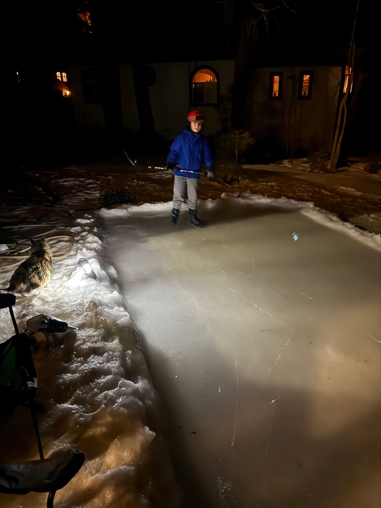
- I’ve given up on new snow and moved on to a mini yard rink. I’d prefer not to say just how long it took to get this small patch… way longer than reasonable!
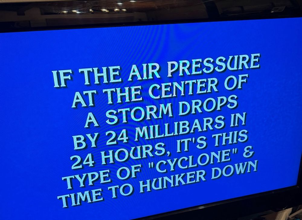
- Great jeopardy question tonight! An even better question… what is the name of the associated unit of measure?
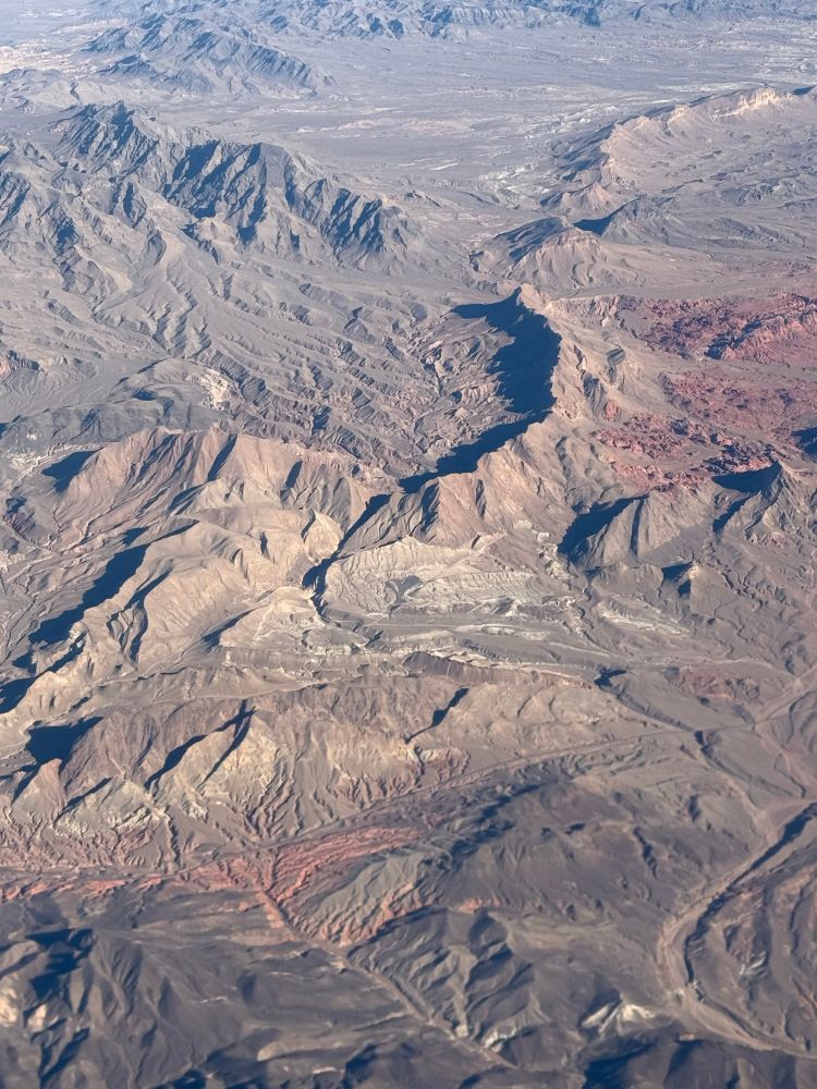
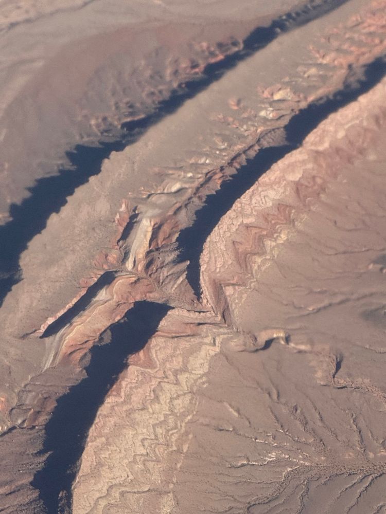
- Two very different landscapes. NV->LA. #AMS2025
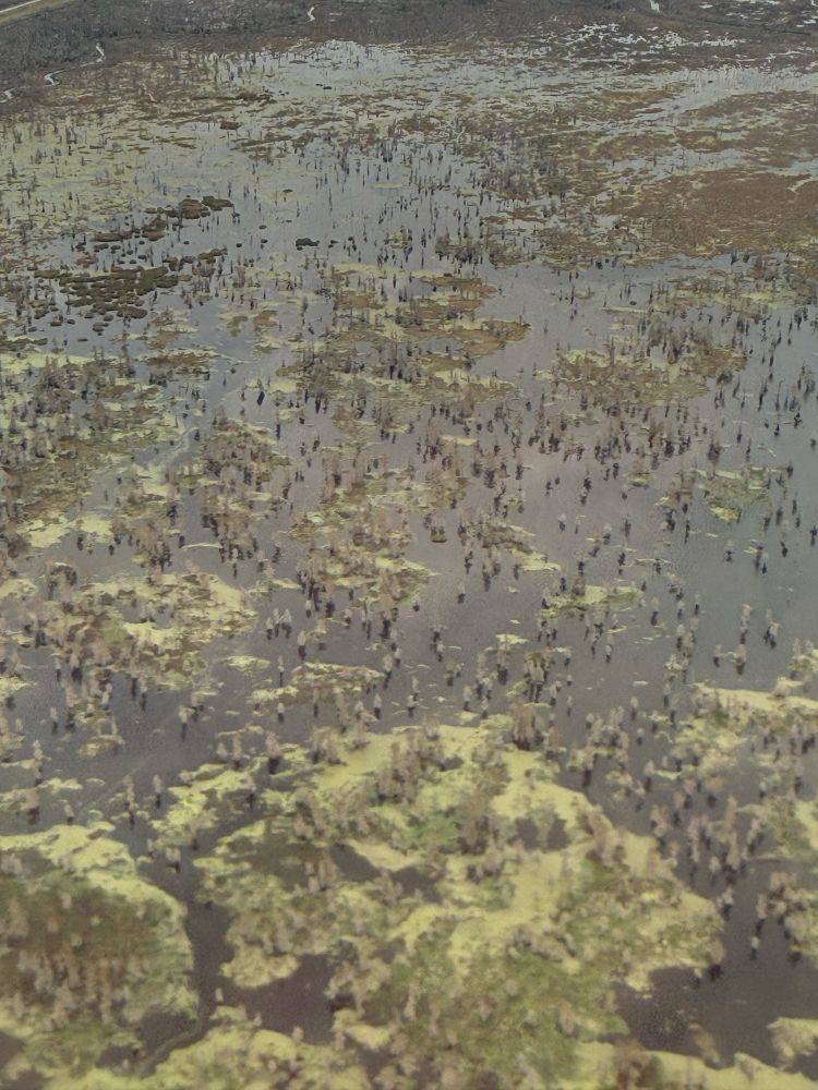
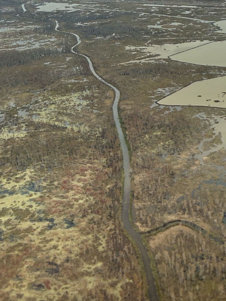
- Another set of contrasting waterways
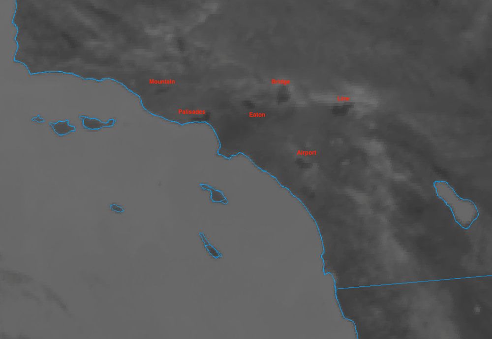
- Was glancing at the Shortwave IR to check for any new heat signatures and noticed that you can clearly see all of 2024/2025's fire scars around the LA basin, including the non-Santa Ana fires like the Bridge and Line fires. The "heat" here is simply the land being hotter due to less vegetation.
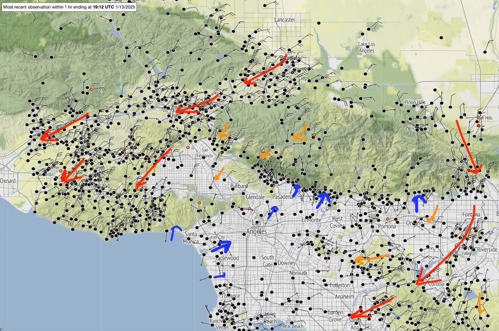
- Typical Santa Ana wind regimes today, with favored gap flow locations exhibiting strong ENE winds, while areas around Pasadena (#EatonFire) remain sheltered with weak westerly flow.
- [Not loaded yet]
- [Not loaded yet]
- My opinion (distinct from fact) is that when homes become the fuels, hardening is profoundly important. It’s a chain reaction of sorts, and if you can break the chain, perhaps you can make dent in the spread.
- Finally. A powder day.
- Beautiful example of the "Shasta County Convergence Zone" generating embedded linear convection, then progressing to an isolated band. #SCCZ
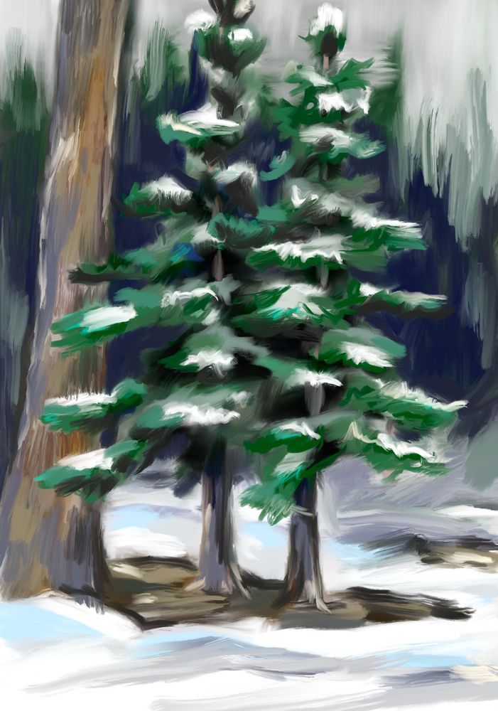
- Winter tree sketch
- Axial tilt, the reason for the season!
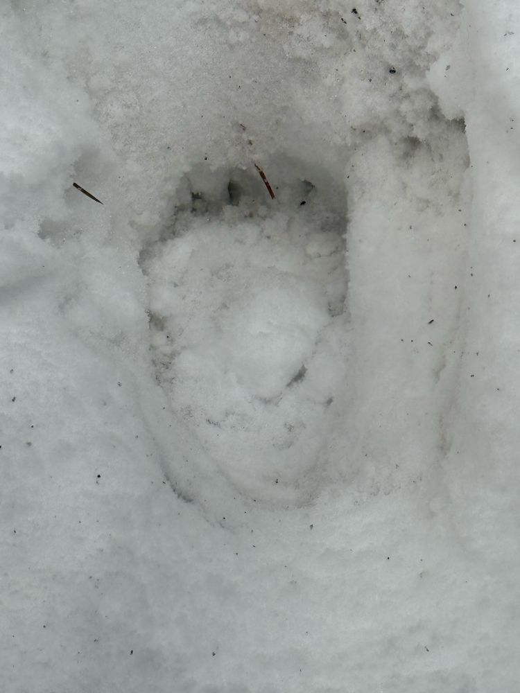
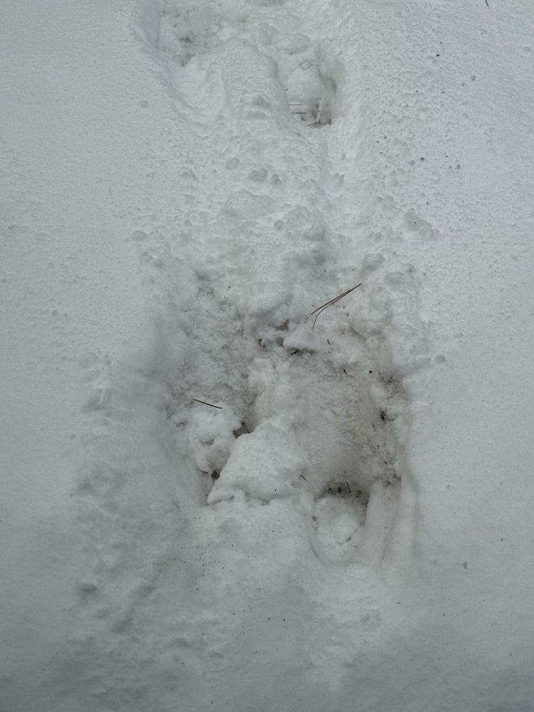
- Unexpected Xmas visitors: 2 bear cubs tried to make off with our grill last night. Hauled the grill and propane tank down the walk before I scared them off. They were after the grease..
- [Not loaded yet]
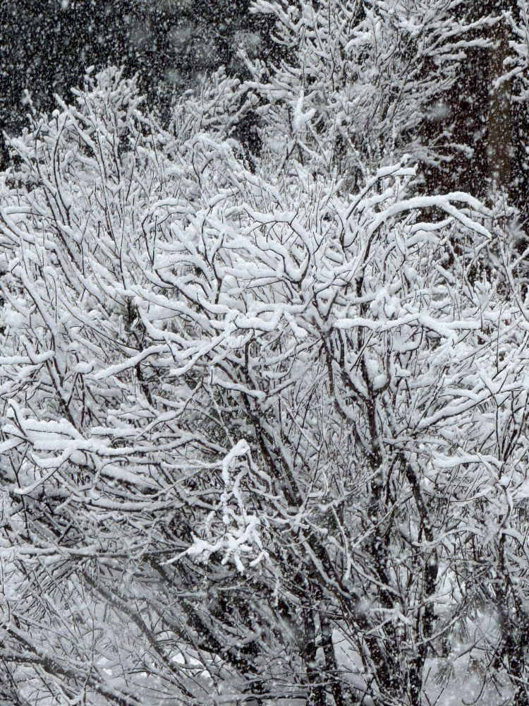
- After days of rain and warm temps, we’re getting a nice new coat of white just in time for Christmas!
- Earlier today in Truckee
- Rapidly deepening cyclone delivers a direct hit for the Bay Area, with strong winds, thunder and lightning, and torrential rains. Significant Sierra snowfalls as well. What a storm! #CAwx
- [Not loaded yet]
- Loving these SITC wx takes!
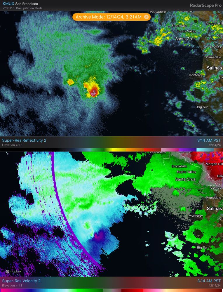
- Quite the cyclonic cell entering Monterey bay @ 3:30 AM!!
- Beauty of a narrow cold-frontal rain band (NCFR) sitting offshore along the north coast this afternoon.
- Was not expecting lightning along the warm front aloft today! A few strikes along the Sierra's western slopes as the stratiform precipitation band really intensified (kinda similar to east coast banded snow storms producing lightning).
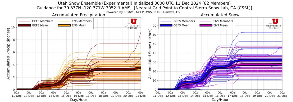
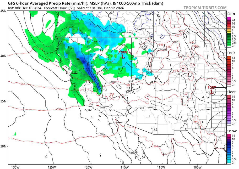
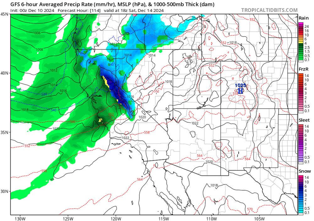
- Having a look at the U-of-U snow ensemble for Thursday and Saturday's systems. Ensemble mean is around 25" at the Central Sierra Snow lab (just west of the Sierra Crest).
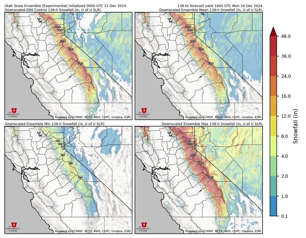
- Excited for a potential 1-2 punch of vigorous systems moving across the Sierra Thurs (left image) and Saturday (right image). Still quite a bit of variability in the Saturday model spread, but I particularly like today's 00z run (wishcasting a bit, eh?).
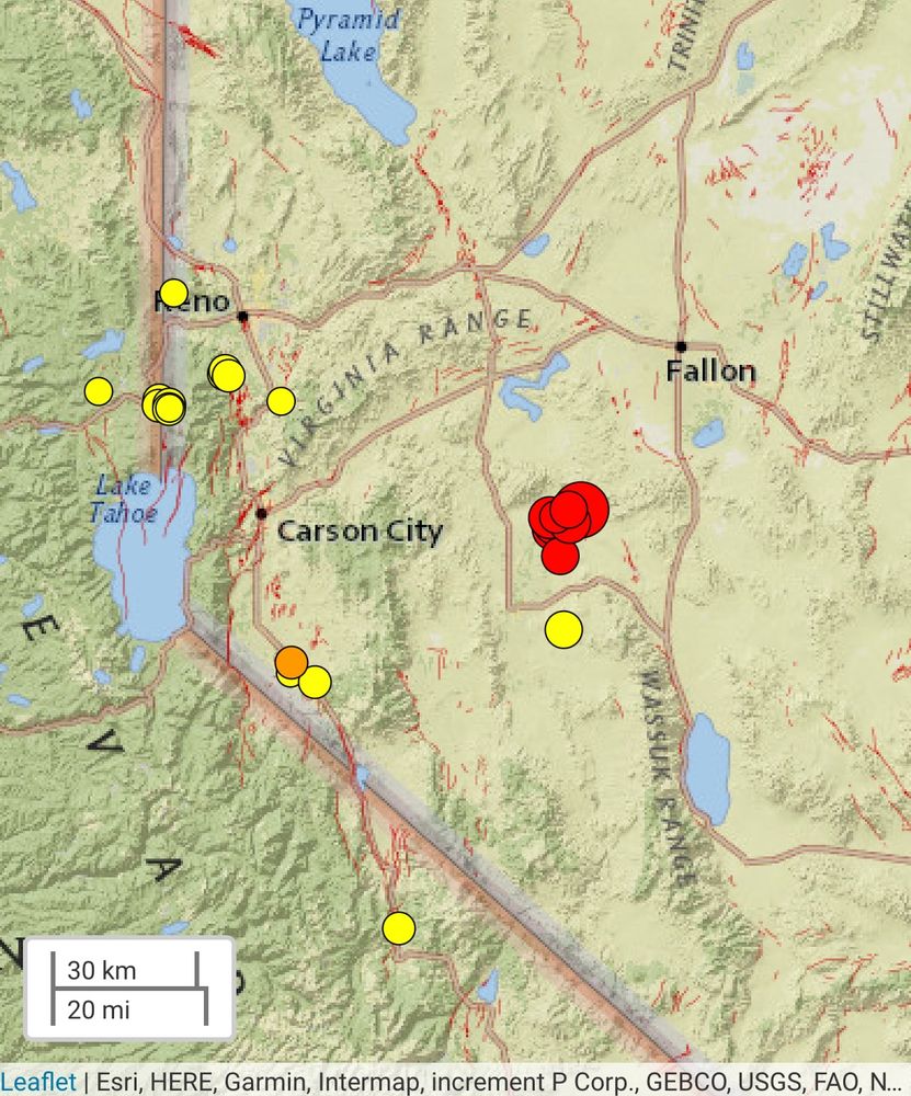
- Got the shake alert for this one in #Truckee. 4th grader did the full drop and cover routine at school. I was outside and didn't feel it.
- M5.5 #earthquake east of Lake Tahoe, shallow strike slip faulting. Quite a few aftershocks already recorded. 🧪⚒️
- [Not loaded yet]
- [Not loaded yet]
- Thanks for the feedback! Tried to adjust the arrow, and to hit your "flatness" comment with some edge shading... does that pop better?
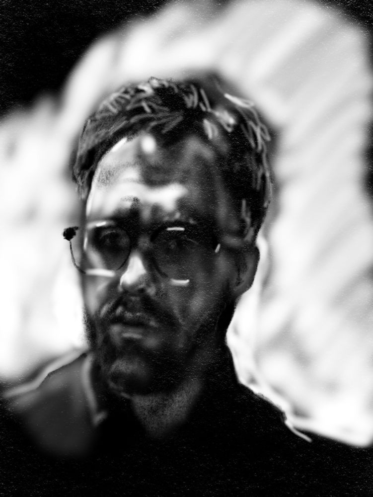
- Self portrait: scientist on a zoom call. iPad art....
- [Not loaded yet]
- Oooh. A touch of updraft helicity!
- [Not loaded yet]
- Yup, that is way better: