Jeff Frame
Teaching associate professor of atmospheric sciences at the University of Illinois. I teach weather. Posts are about weather and sometimes sports. Storm chaser. PhD, MS PSU; BS Michigan. All opinions mine.
https://vortexjeff.smugmug.com
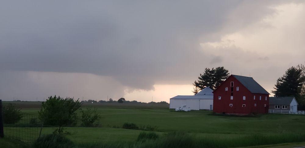
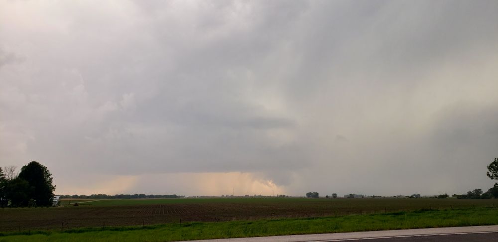
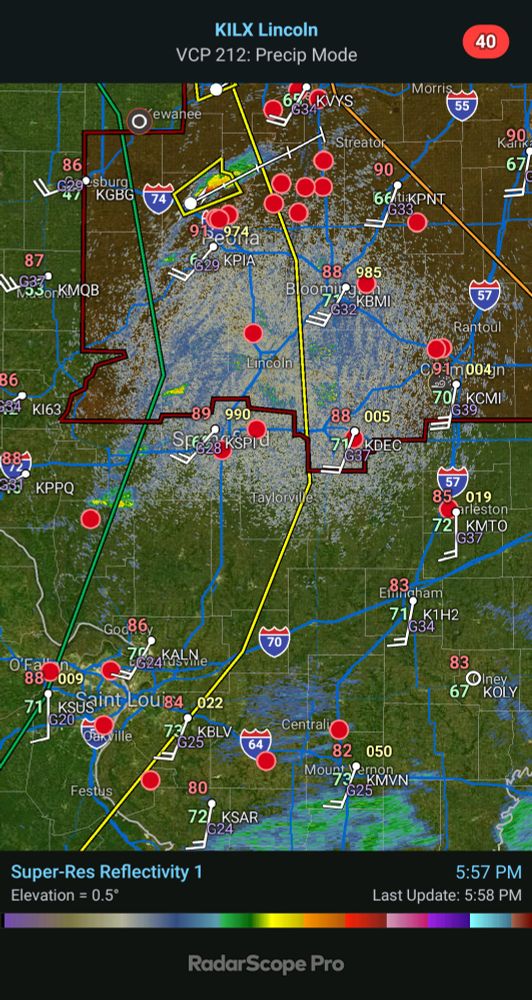
- 634pm: Tornado warned supercell near Decatur, IL
- 716pm: Supercell west of Niantic, IL. Cannot determine rotation from my location
- Going to take a spin down I-72
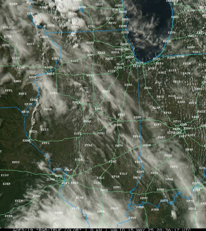
- The band of towering cumulus clouds just east of the Mississippi River might develop into storms as it moves eastward. #ILwx
- Technical discussion for local severe weather (mostly hail/wind) potential
- [Not loaded yet]
- Mostly like after 6-7pm, if a storm forms and moves into town
- Reminders of areas to avoid for anyone chasing today
- [Not loaded yet]
- Bad terrain in SW WI and Chicagoland
- I'm going to spend most of the day grading in my office, but I may head toward Gibson City later if satellite trends are encouraging.
- This also doubles as the hypothetical storm chasing target for today. It would be a scramble east, but we'd already be on the road.
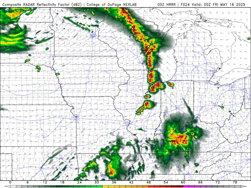
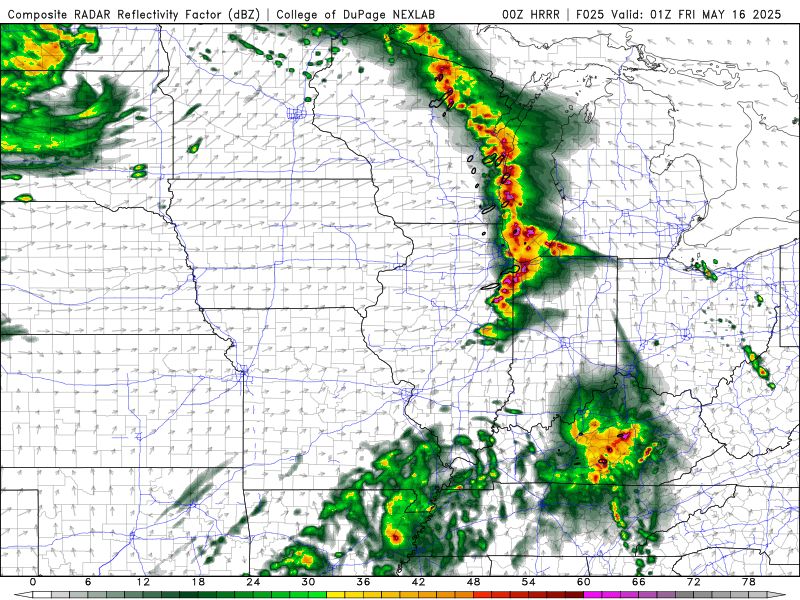
- Latest HRRR model rapidly develops storms west of Champaign-Urbana tomorrow evening, but kills them just as quickly due to outflow from a storm complex to the south
- [Not loaded yet]
- Good idea!
- [Not loaded yet]
- Around 7pm
- [Not loaded yet]
- It was spouting off today
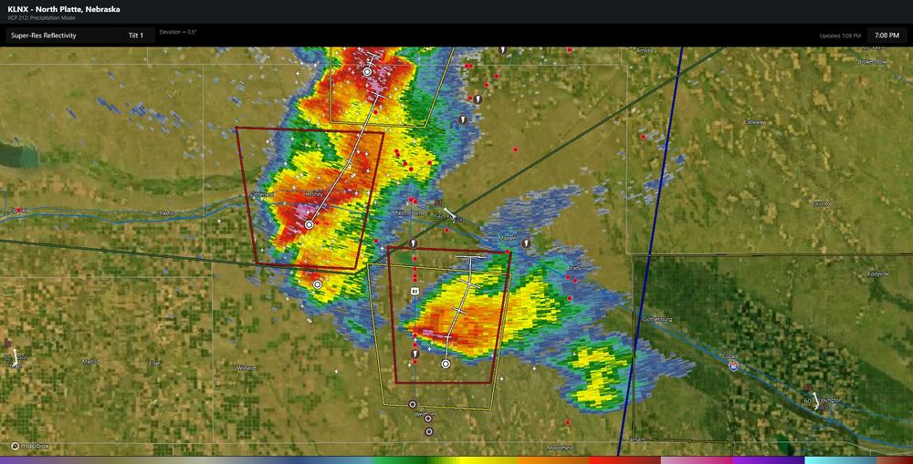
- Hypothetical storm chasing target: Cozad, Nebraska
- Gotta stick with it at this point. Probably better than anything over good terrain that's reachable tomorrow anyway.
- Again!
- Boom!
- Cold air funnel capital of the world strikes again!
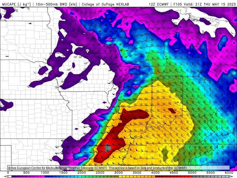
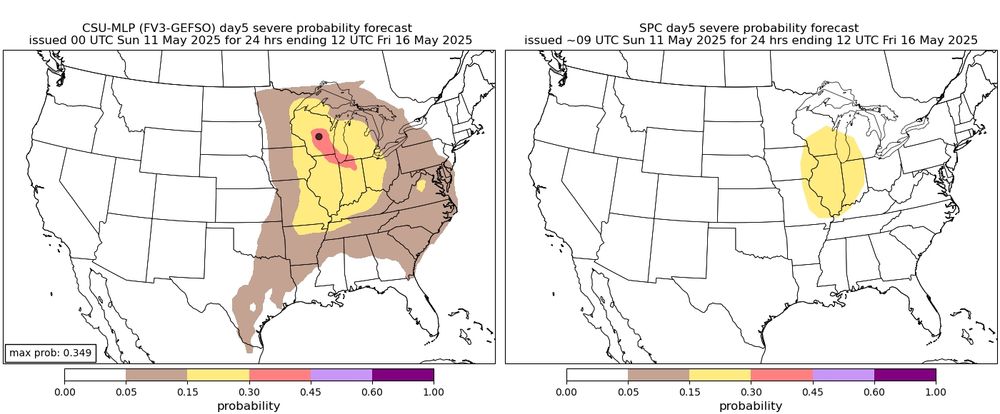
- Global models indicate a potentially volatile environment over Illinois ahead of a cold front on Thursday afternoon. The Euro, for example, indicates bulk shear of 40-50 knots overspreading 3000+ J/kg CAPE. Most other global models are similar. 1/3
- [Not loaded yet]
- I give my last final exam Wednesday night, but I still have to grade those exams. With graduation next weekend and then prepping my field course, which leaves on 5/22, I doubt that I'll be able to take all day Thursday to chase central Iowa. A local chase would be much easier logistically. 2/2
- It does, and this will be an interesting test of the experimental MPAS model. From experience, many, but all, big Midwestern cyclones slow in modeling with decreasing forecast lead time. 1/2
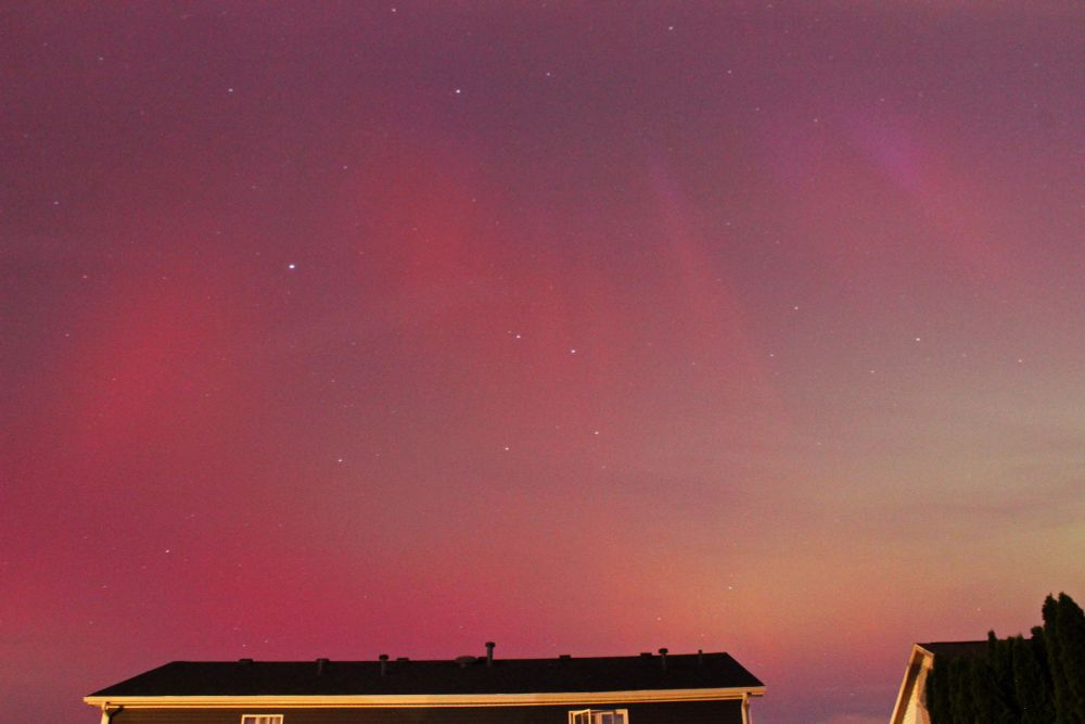
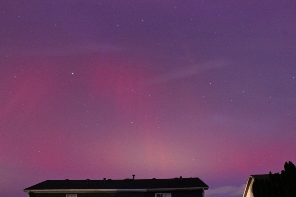
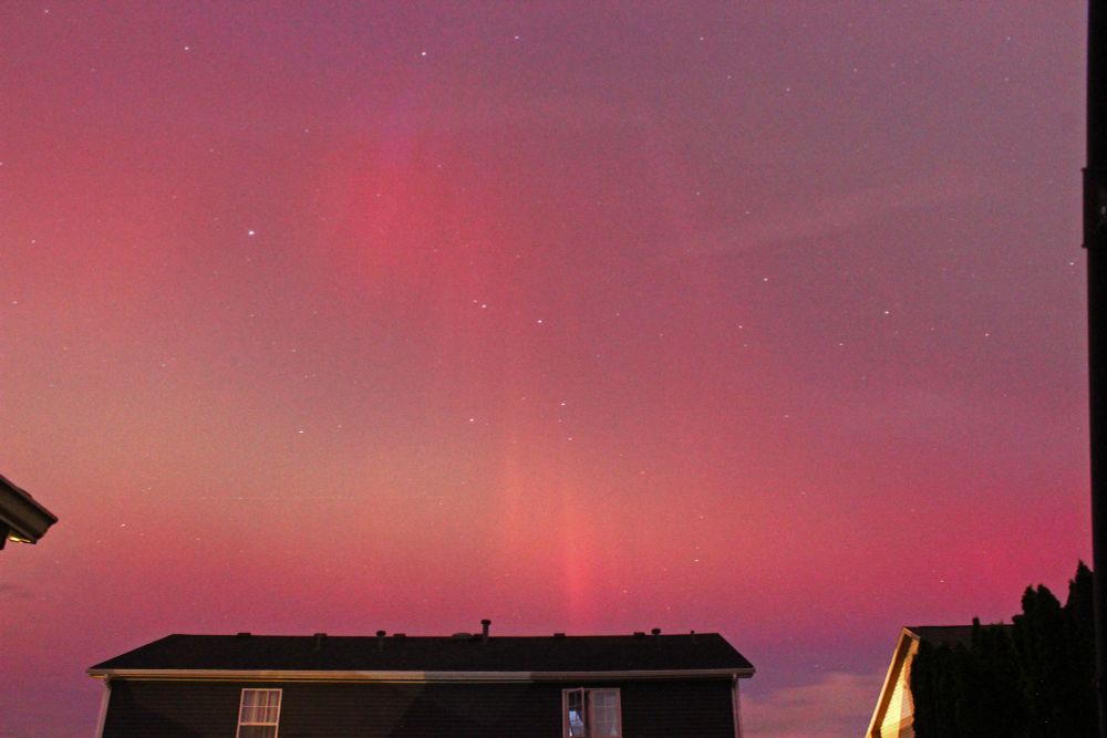
- One year ago, I saw aurora visible to the naked eye looking south.
- [Not loaded yet]
- Urbana, IL
- If storms initiate in this environment, they would be capable of all severe hazards. CSU machine learning guidance is not extremely bullish, however, and this may be related to several GEFS ensemble members struggling to initiate convection. 2/3
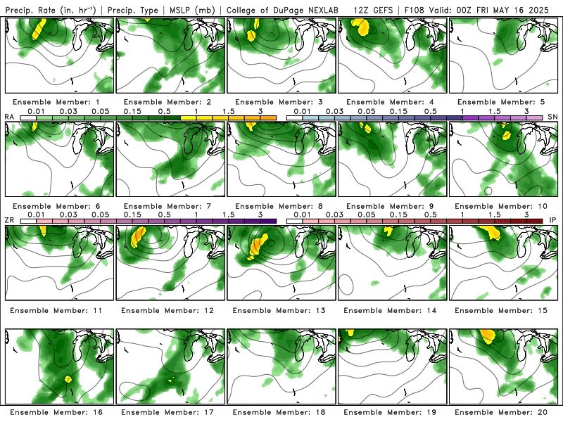
- Interestingly, the experimental convection allowing MPAS ensemble from NCAR is much slower, with most members initiating storms over Iowa Thursday afternoon, which then grow upscale and move across portions of central Illinois late Thursday night. www2.mmm.ucar.edu/projects/nca... 3/3
- Hypothetical storm chasing target: Livingston, AL. Probably junk. Brutal pattern.
- 🗑️
- [Not loaded yet]
- [Not loaded yet]
- My last final is Wednesday night
- A Lake Michigan-enhanced cold front passed about an hour ago, and the temperature in Champaign-Urbana has dropped 12°F since then with a gusty northeast wind.
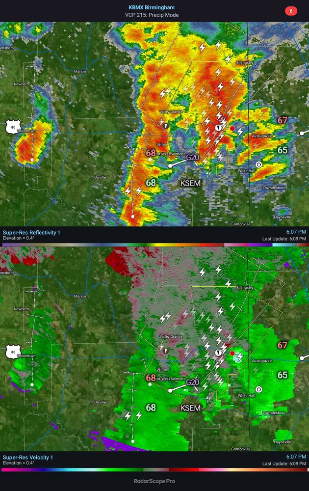
- Hypothetical storm chasing target: Uniontown, AL. Surface low shenanigans in a pocket of decent terrain?
- There was an attempt
- [Not loaded yet]
- [Not loaded yet]
- It was reposted. Not sure why it was deleted
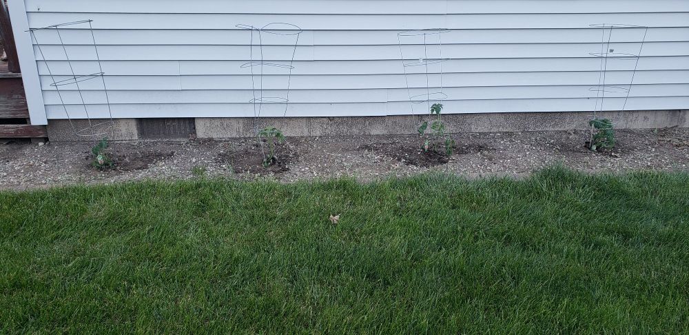
- Multiple tomatoes in the ground!
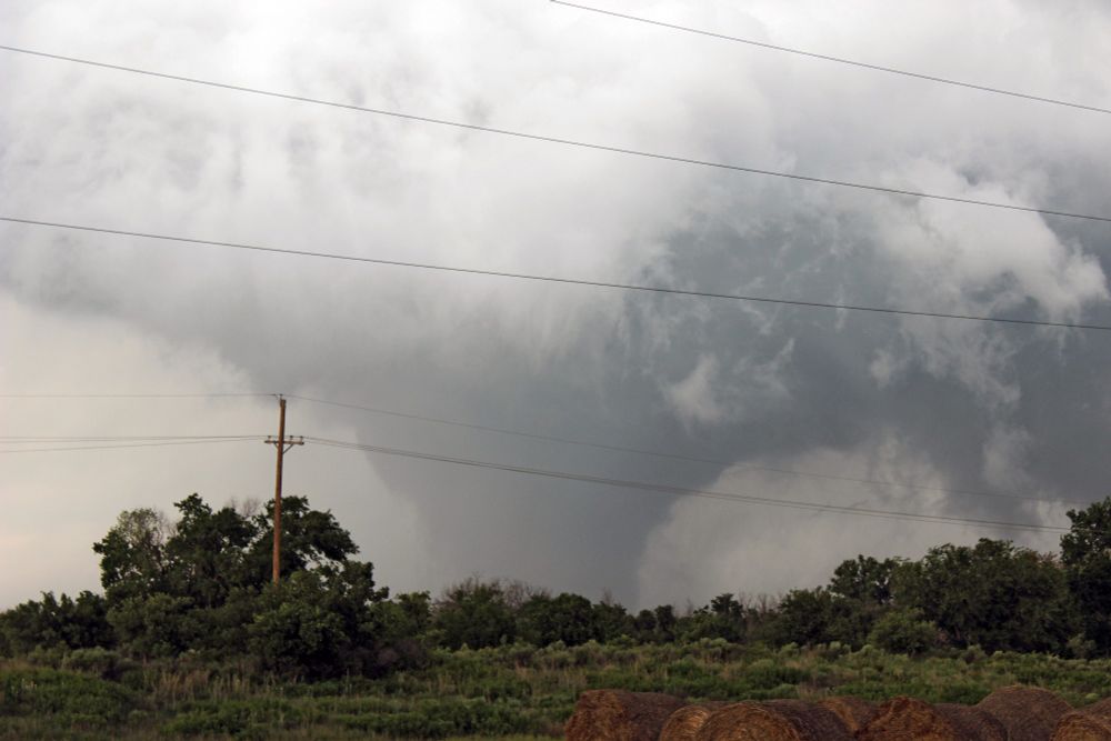
- Post a pic from ten years ago. Canadian, TX, 5/27/2015
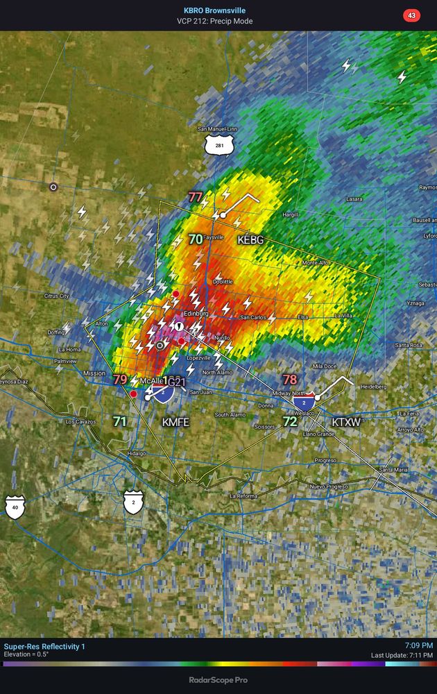
- A couple of chasers on this supercell in Deep South Texas
- [Not loaded yet]
- [Not loaded yet]
- Also the year US temperature records began
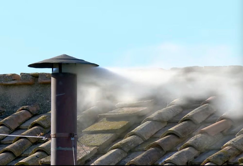
- A little METAR fun: SPECI LIRF FU RMK WHITE SMOKE
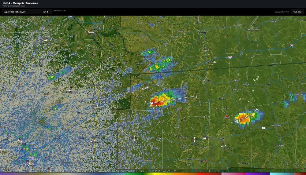
- Hypothetical storm chasing target: Jackson, TN, by noon. Maybe see something before it moves into the trees?
- I like minis, but I need to borrow a chainsaw
- I'll take that today
- Hypothetical storm chasing target: Bristow, OK. Upper-low shenanigans?
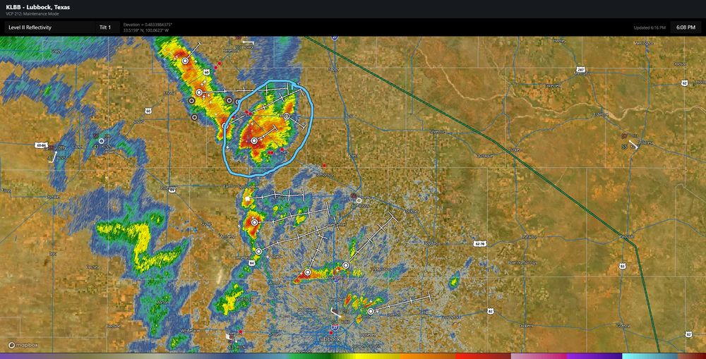
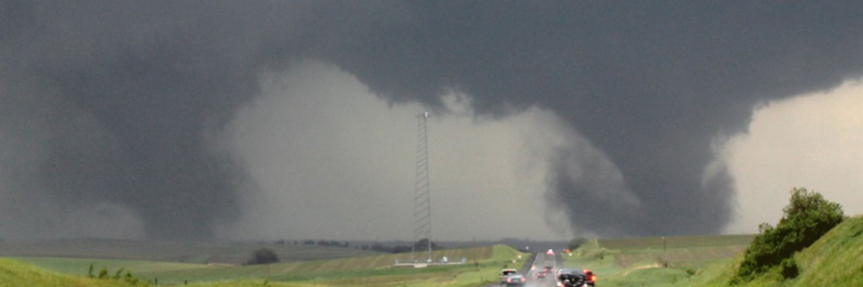
- If chasing west is an option, you generally should, and these pictures from two different storms near Lubbock demonstrate why. Last Thursday was an exception owing to an outflow boundary farther east, however.
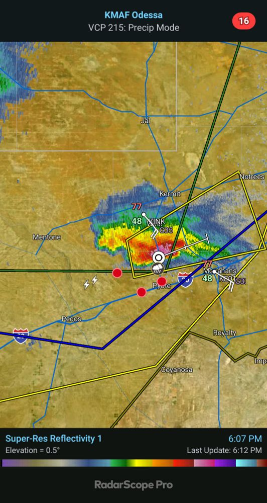
- Hypothetical storm chasing target (late because of a busy morning at work): Lubbock, TX. You knew I was going west today.
- It's not a QLCS, so I'll take it
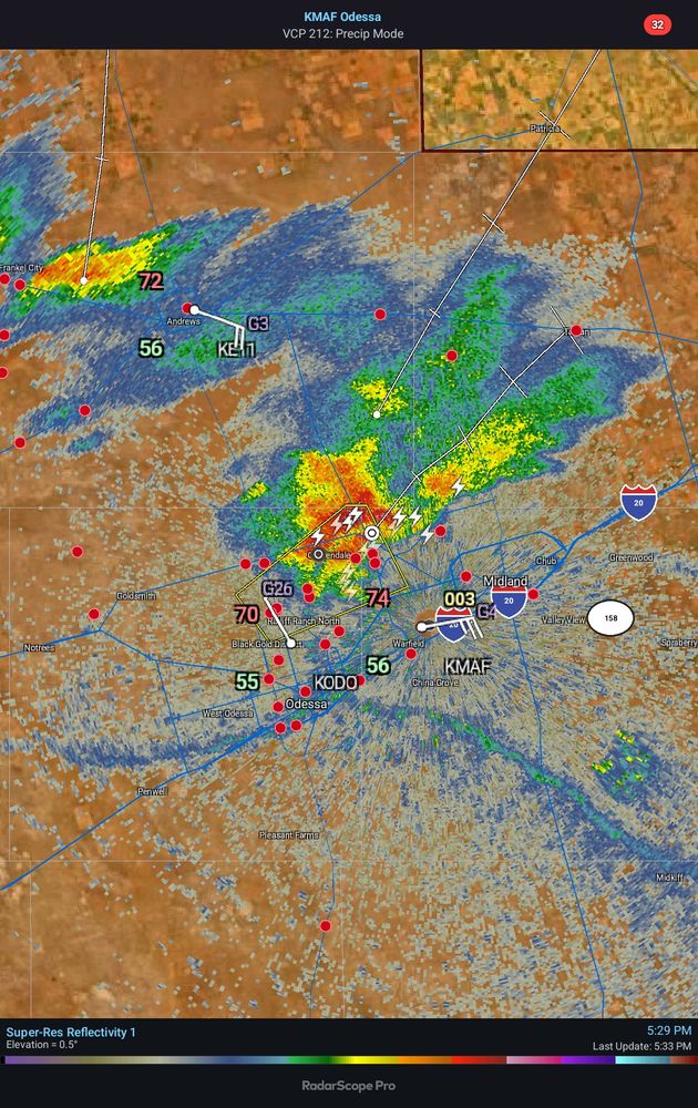
- Hypothetical storm chasing target: Midland, TX. I think that the HRRR is too aggressive with vertical mixing and depleting the CAPE too quickly in this area.
- [Not loaded yet]
- I saw a lot of folks leave it, but I wasn't sure why. I likely would have stayed with it given downstream obs
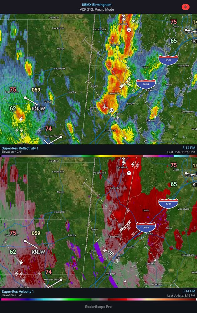
- That's a supercell, but it didn't latch onto the boundary.
- [Not loaded yet]
- [Not loaded yet]
- Thanks - I always share my real ones
- 👍