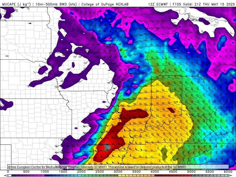
- Global models indicate a potentially volatile environment over Illinois ahead of a cold front on Thursday afternoon. The Euro, for example, indicates bulk shear of 40-50 knots overspreading 3000+ J/kg CAPE. Most other global models are similar. 1/3
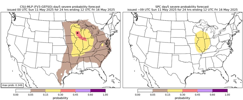
- If storms initiate in this environment, they would be capable of all severe hazards. CSU machine learning guidance is not extremely bullish, however, and this may be related to several GEFS ensemble members struggling to initiate convection. 2/3
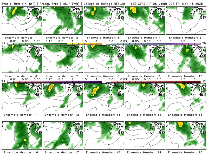
- Interestingly, the experimental convection allowing MPAS ensemble from NCAR is much slower, with most members initiating storms over Iowa Thursday afternoon, which then grow upscale and move across portions of central Illinois late Thursday night. www2.mmm.ucar.edu/projects/nca... 3/3
- The NCAR model makes Des Moines look like the target
- It does, and this will be an interesting test of the experimental MPAS model. From experience, many, but all, big Midwestern cyclones slow in modeling with decreasing forecast lead time. 1/2May 11, 2025 21:58