
EOMasters
🛰️🌍Software, Knowledge, Community. EOMasters provides everything to enhance your daily work with Earth Observation data. Be faster, be more productive, have more fun. linktr.ee/eomasters
IMPRINT: eomasters.org/imprint
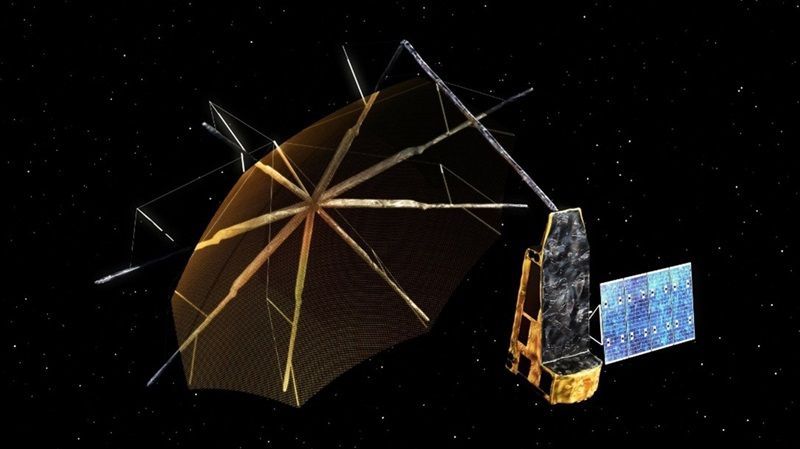
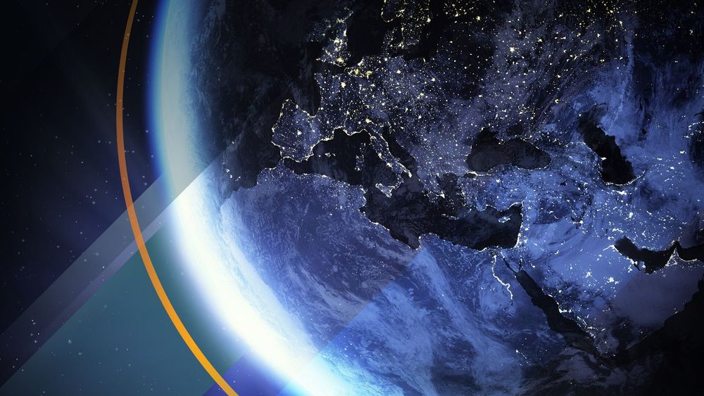
- Biomass is in orbit, but we have to wait a bit for the data. The first L1 and L2 data are expected to be distributed in 𝗝𝗮𝗻𝘂𝗮𝗿𝘆 𝟮𝟬𝟮𝟲. What happens until then is covered in this article. #earthobs #remotesensing buff.ly/PPUJlm1
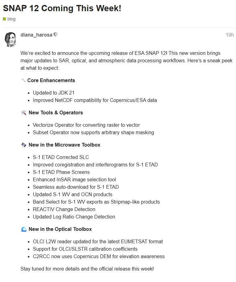
- It seems it is real! SNAP 12 is coming soon! forum.step.esa.int/t/snap-12-co...
- Great! The ESA SNAP Toolbox is now also on Bluesky. Let them welcome here. #earthobservation #remotesensing
- Reposted by EOMasters[Not loaded yet]
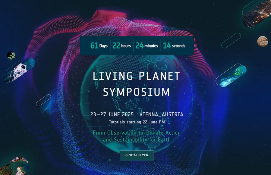
- Living Planet Symposium 2025 Have you already registered? I did 🙂 buff.ly/RWnTi3F
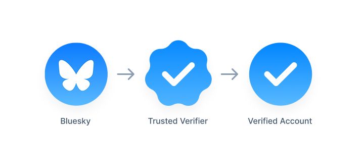
- Reposted by EOMastersWe’re introducing a new layer of verification on Bluesky — a user-friendly, easily recognizable blue check. In addition to account verification issued by Bluesky, we're also introducing Trusted Verifiers. Select independent organizations can verify accounts directly.
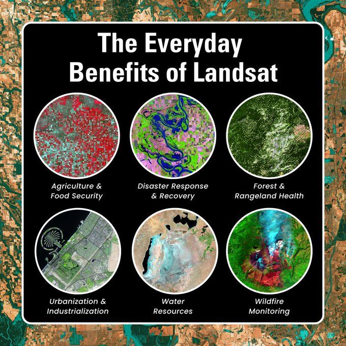
- Reposted by EOMastersFor 50+ years, #Landsat 🛰️ has captured the changing face of Earth, creating an #EarthObservation record that continues to provide countless #SocietalBenefits. How has Landsat benefited your community? #gischat #eochat ow.ly/oPQ050VBGwx
- A reader for #EMIT data for @esa.int SNAP is available via the EOMasters Pro Toolbox. www.eomasters.org/eom-software... #eoobs #remotesensing
- Reposted by EOMasters[Not loaded yet]
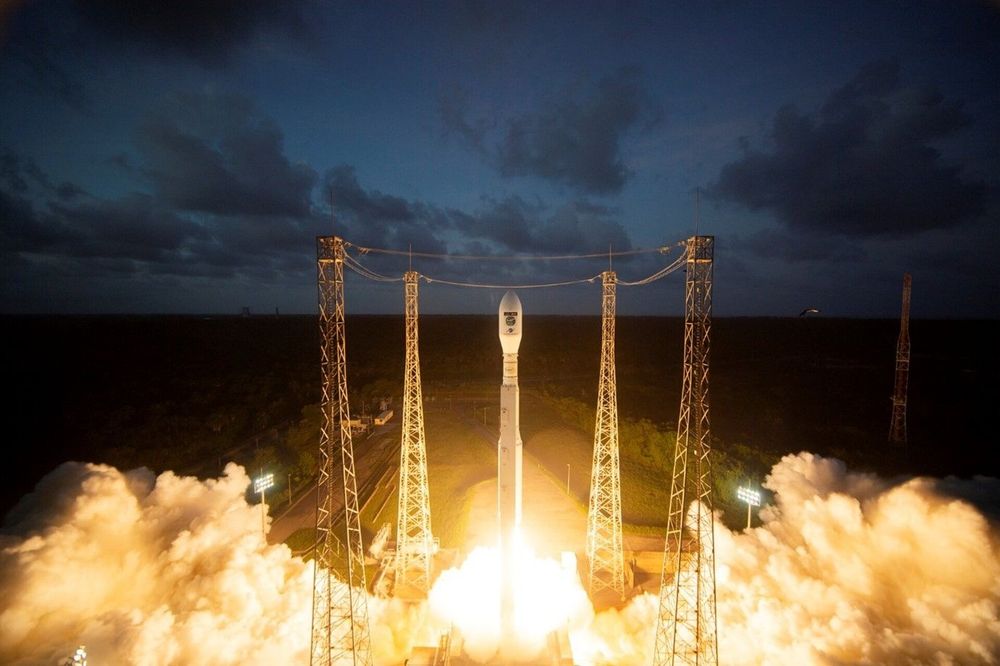
- Sentinel-1C User Data available 𝗧𝗢𝗗𝗔𝗬 While the commissioning activities are still ongoing, first access to #Sentinel1C data is granted. It should be noted that data calibration and validation remain preliminary. #earthobs #remotesensing
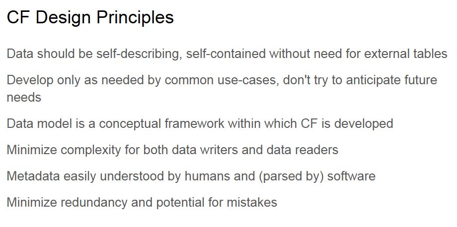
- 𝗖𝗙 𝗠𝗲𝘁𝗮𝗱𝗮𝘁𝗮 𝗖𝗼𝗻𝘃𝗲𝗻𝘁𝗶𝗼𝗻𝘀 support #OpenScience by automating processes via metadata in #NetCDF and #Zarr files. They establish a unified language for the #weather, #climate, #ocean, and #EO community. buff.ly/Vmtz6zH #remotesensing #EarthObs
- ESA has outlined its 15-year strategy, based on five key goals. * Protect our Planet and Climate * Explore and Discover * Strengthen European Autonomy and Resilience * Boost Growth and Competitiveness * Inspire Europe More: buff.ly/bJTCM6c #earthobs #remotesensing
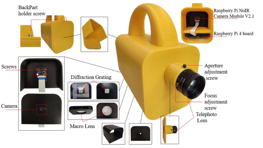
- Do you need a 𝗵𝘆𝗽𝗲𝗿𝘀𝗽𝗲𝗰𝘁𝗿𝗮𝗹 𝗰𝗮𝗺𝗲𝗿𝗮 for less than 𝟮𝟬𝟬€. Here is you can find a guide to build your own. buff.ly/1DIQQ8p #remotesensing #earthobservation
- Reposted by EOMasters[Not loaded yet]
- Reposted by EOMasters[Not loaded yet]
- 𝗨𝗦𝗚𝗦 𝗿𝗲𝘁𝗶𝗿𝗲𝗱 𝗟𝗮𝗻𝗱𝘀𝗮𝘁𝗟𝗼𝗼𝗸 - Users need to familiarise with other tools now. This cloud tool enabled users to create and view custom mosaics, choose bands, and develop spectral indices for online analysis. buff.ly/A4Jc9fh #EarthObs #remotesensing
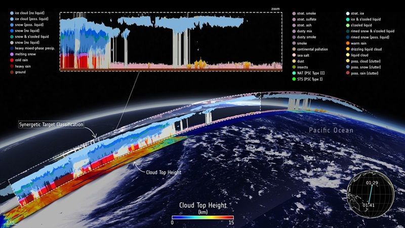
- Now fully available! 𝗘𝗮𝗿𝘁𝗵𝗖𝗔𝗥𝗘’𝘀 𝗟𝗲𝘃𝗲𝗹-𝟮 data products. L2A contains data from individual instruments, and L2B provides data from two instruments. Final L2 data will be ready by year-end, integrating information from all four instruments. buff.ly/EAz9ZlZ #EarhtObs #remotesensing
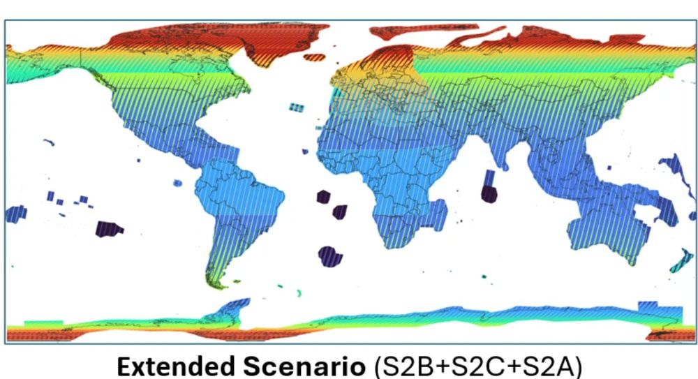
- ⏰𝗥𝗲𝗺𝗶𝗻𝗱𝗲𝗿⏰ The #Sentinel-2A extension campaign begins in 𝘁𝘄𝗼 days, improving the global revisit frequency of the Sentinel-2 constellation. Particularly beneficial for observing tropical regions in Africa and South America with high #cloud cover. buff.ly/lTEENhP #earthobs #remotesensing
- Reprocessing of 𝗢𝗟𝗖𝗜 𝗟𝗮𝗻𝗱 𝗟𝟮 started. The reprocessed Level-2 Land products will gradually become available on the Copernicus Data Space Ecosystem starting from 10 March 2025. buff.ly/32zCF7E #remotesensing #earthobs
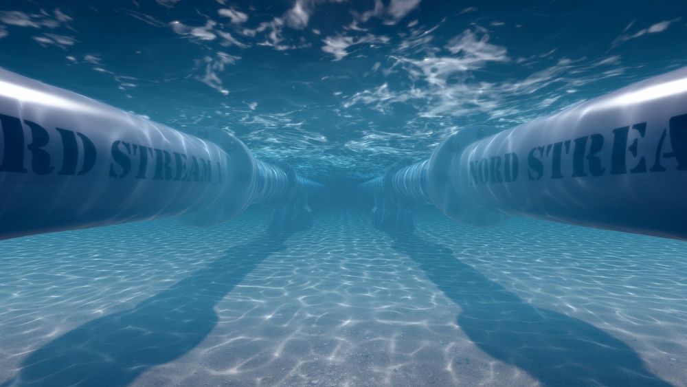
- A #Nature study reveals that 445k to 485k tonnes of methane leaked from Nord Stream in 2022. Initial estimates suggested a range of 75k to 230k tonnes. Several satellites helped to get to these new numbers. buff.ly/TsyFqRH #remotesensing #earthobs
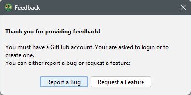
- #EOMasters Toolboxes updated 🚀 The Pro TBX fixed an issue 🐞 with the ASTER data reader using gpt. The Basic TBX now allows easy feedback 📣 (also for Pro) via 𝗘𝗢𝗠𝗧𝗕𝗫 𝗙𝗲𝗲𝗱𝗯𝗮𝗰𝗸 in the help menu for bug reports or feature requests. buff.ly/7SGi150 #eoobs #esa_snap
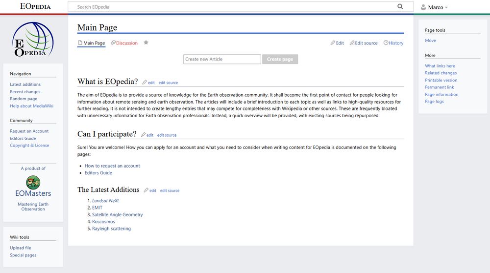
- Do you think you have some knowledge in Earth Observation? Would you like to share it? #EOpedia is the place you can do so. You can show your expertise and help others to educate themself. www.eopedia.org #eoobs #community #remotesensing #eochat
- I'm very sorry to hear this, @zacklabe.com. And you work is definitely of public interest. Your social media accounts show this. I'm not sure how much effect the letter will have. But it's better than remaining silent.
- Dear EOMasters, The Union of Concerned Scientists (UCS) invites you to support a letter defending NOAA. This letter highlights NOAA's vital role in climate monitoring and urges US Congress and the Trump administration to maintain its funding and protect its science. Raise your voice.
- Have you seen 𝐒𝐞𝐧𝐭𝐢𝐕𝐢𝐬𝐭𝐚 already? It shows great examples of #Sentinel Data applications🌍 and nice 3D models of the satellites ���️ buff.ly/41BFWtZ #remotesensing #earthobs
- The HEDAVI (HEritage DAta VIsualisation) (buff.ly/43iwBbA ) platform now provides access to Sentinel-2 L1c and L2a data, also the Sentinel-2 Cloudless basemaps is available and a new Water Quality Index. buff.ly/43exYrO
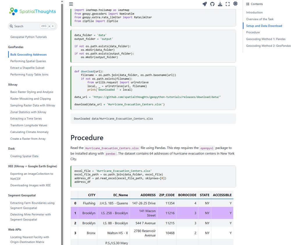
- 𝗚𝗲𝗼𝘀𝗽𝗮𝘁𝗶𝗮𝗹 𝗣𝘆𝘁𝗵𝗼𝗻 𝗧𝘂𝘁𝗼𝗿𝗶𝗮𝗹𝘀 SpatialThoughts provides tutorials covering a broad range of geospatial topics and technologies, e.g., #GeoPandas, #XArray, #dask, and more. Each technology is described in a notebook with step-by-step explanation. Check it out: buff.ly/4ha3HOo
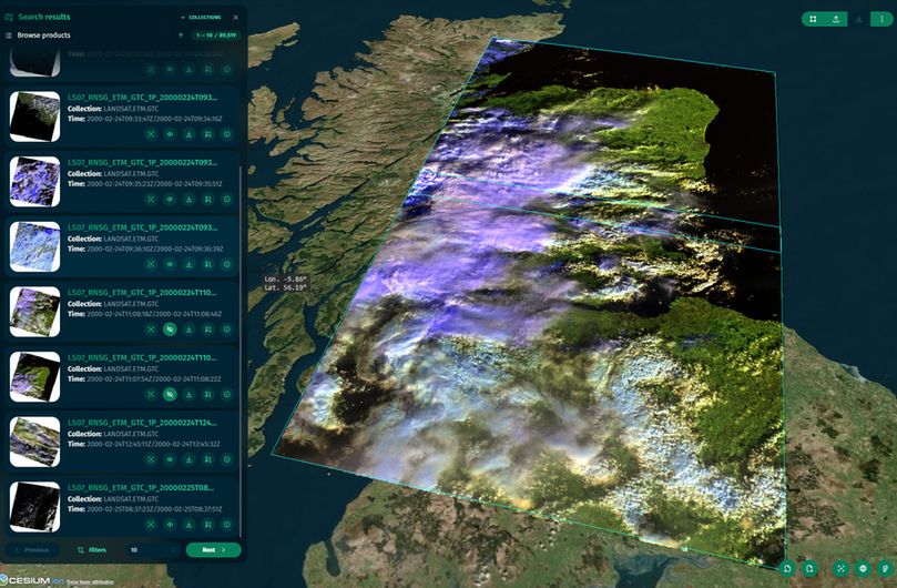
- Explore real-time satellite data with Exploring Earth! #ESA launched a new web application that provides access to datasets from ESA's Earth Explorers, Heritage missions, and Third-Party Missions. buff.ly/3QqpTc5 #earthobservation #remotesensing
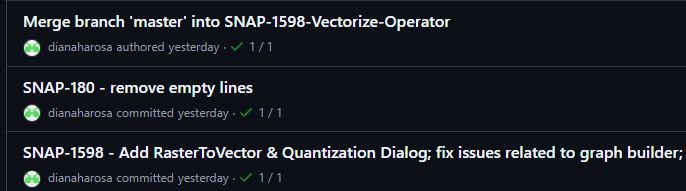
- Look what I found! #ESA_SNAP will get a 𝗥𝗮𝘀𝘁𝗲𝗿-𝘁𝗼-𝗩𝗲𝗰𝘁𝗼𝗿 function. It will be great to be able to #vectorize data. Along with vectorization also comes quantization of data. Nice! buff.ly/4i6uzzn #EarthObervation #remotesensing
- Reposted by EOMasters[Not loaded yet]
- Reposted by EOMasters[Not loaded yet]
- Reposted by EOMasters[Not loaded yet]
- Have you also had problems downloading #EO data from CDSE the last days? Now it seems to be fixed. However, it is still possible to see 404 errors. They are working on this. sentinels.copernicus.eu/-/update-cdse-eodat… #remotesensing #earthobservation
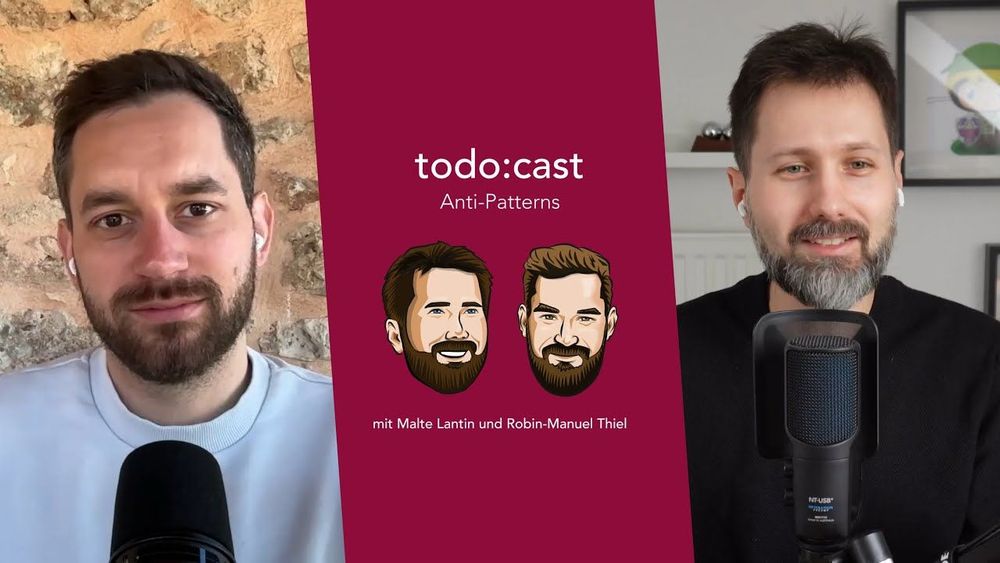
- For the German developers among my followers. I like to watch/listen the 𝘁𝗼𝗱𝗼:𝗰𝗮𝘀𝘁 regularly. I think it is underrated. buff.ly/4b1cXCL buff.ly/4jZ6Kvp #software #podcast
- 🌊 Discover the Coastal Map by EOMasters! The high-resolution map provides indicators for coastal areas, supporting diverse ecosystems. Perfect for researchers, environmentalists, and policymakers. Explore more here buff.ly/3EAqwx3 #CoastalMap #Sustainability #ClimateAction #EarthObservation
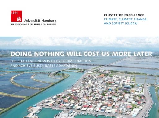
- The new issue of CLICCS Quarterly is out! It’s essential reading for those interested in climate change, focusing on the crucial topic of sustainable adaptation and the importance of immediate action. buff.ly/42QYXJM #climate
- Reposted by EOMasters[Not loaded yet]
- Reposted by EOMasters[Not loaded yet]
- Reposted by EOMasters[Not loaded yet]
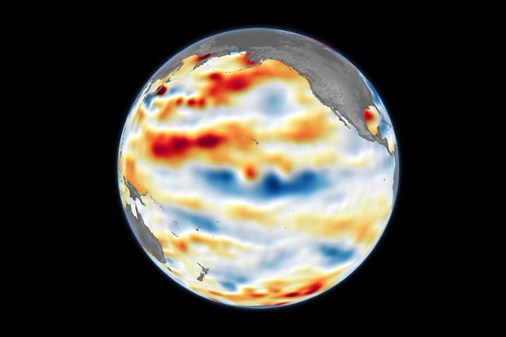
- La Niña is visiting, but probably not for long The phenomenon appeared in early December 2024, after seven months of waiting. And will probably not stay long. Stronger-than-usual trade winds push warm surface waters westward. buff.ly/3WO07BR #sentinel6 #remotesensing #earthobs
- Sentinel-2A extended mission explained TL;DR Sentinel-2A will continue meeting user demands for data, enhancing Earth Observation capabilities, and providing more frequent and reliable data for various applications. buff.ly/3WUeAfQ #remotesensing #earthobservation #sentinel2
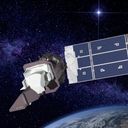
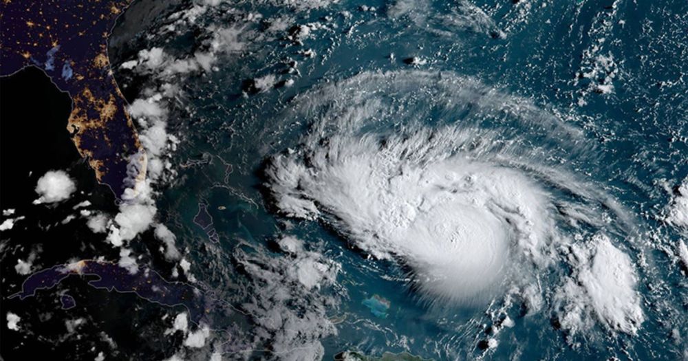
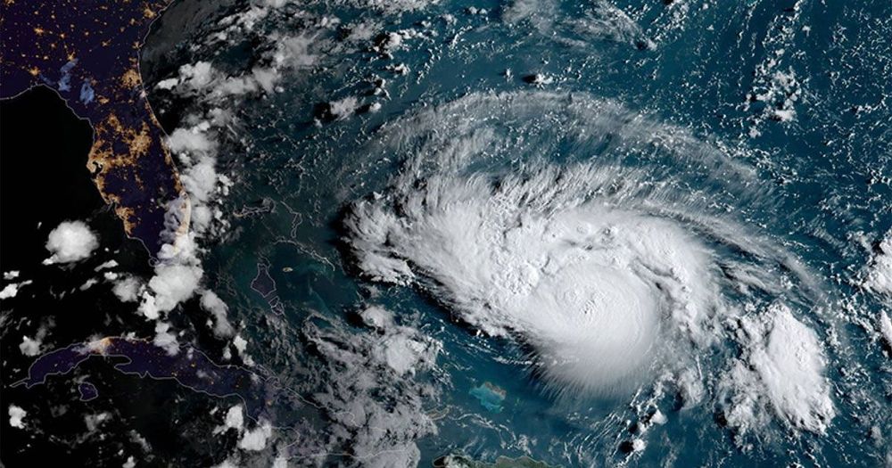
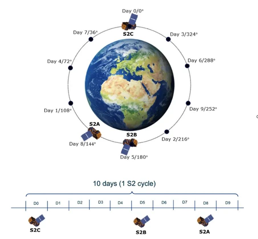
- The way to Sentinel-1C operations This article describes the steps from the launch of the satellite to the distribution of the images. #remotesensing #sentinel1
- 𝗤𝗚𝗜𝗦 𝗶𝘀 𝗻𝗼𝘄 𝗮 𝗗𝗶𝗴𝗶𝘁𝗮𝗹 𝗣𝘂𝗯𝗹𝗶𝗰 𝗚𝗼𝗼𝗱 A Digital Public Good is a digital solution that meets the DPG Standard (open-source, respects privacy, adheres to best practices, and contributes to sustainable development). buff.ly/3CFkEC2 #gis #remotesensing
- QGIS reports on its Grant Programme 2024 and the seven winners. blog.qgis.org/2025/02/07/reports-… #remotesensing #gis #earthobservation
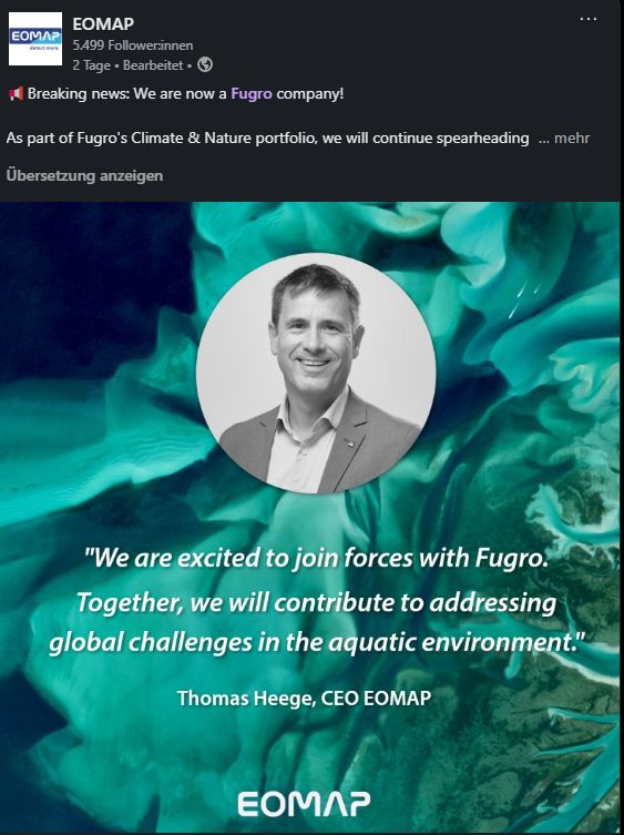
- Fugro, a multinational company based in the Netherlands, bought last week the German company EOMAP, known for its expertise in mapping and monitoring of marine and freshwater environments. Read more in the press release: buff.ly/3Es37O7 #earthobs
- Reposted by EOMasters[Not loaded yet]
- Reposted by EOMasters[Not loaded yet]
- Reposted by EOMasters[Not loaded yet]
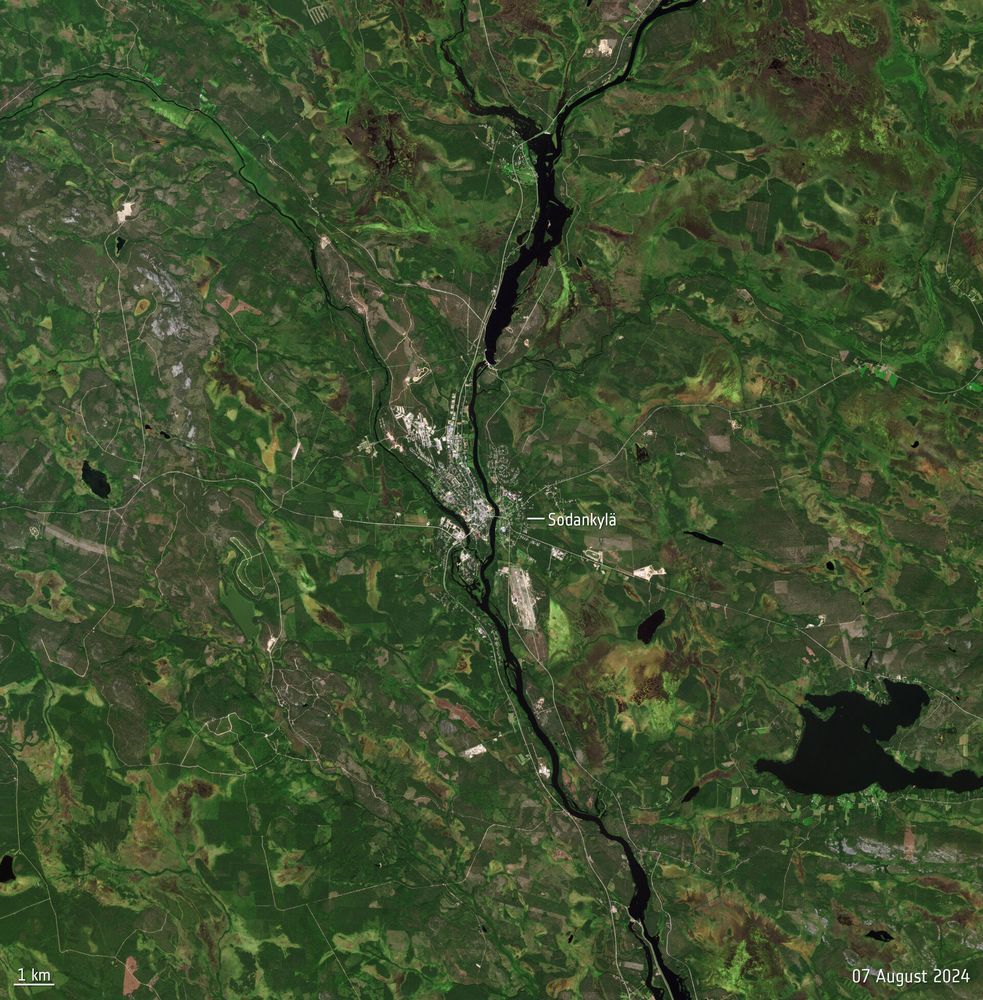
- New Cal/Val site near Sodankylä (Finland) for forest-tundra in development. esa.int/Applications/Observ… More Cal/Val data needed. Have a look at calvalportal.ceos.org
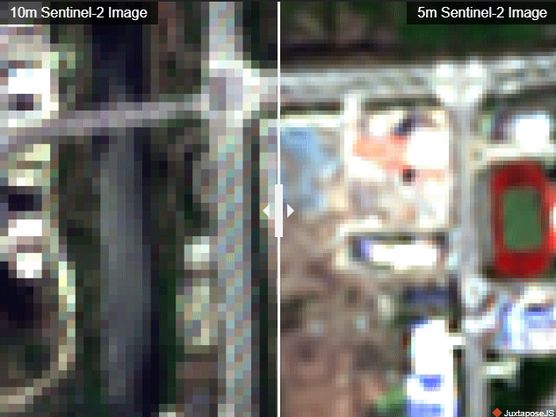
- Not even half a year old but already grown so much. The EOMasters Pro Toolbox provides * For Sentinel-2 Geometry Up-scaling, 5m Super-Resolution and SR Normalisation * ASTER L1T and EMIT L1B/L2A Reader * A Coastal Map * Spectral Index Library - SpeX * Asset Library eomasters.org/eom-s…
- Reposted by EOMasters[Not loaded yet]
- 𝗘𝗮𝗿𝘁𝗵 𝗢𝗯𝘀𝗲𝗿𝘃𝗮𝘁𝗶𝗼𝗻 𝗗𝗮𝘁𝗮 𝗦𝗰𝗶𝗲𝗻𝗰𝗲 𝗖𝗼𝗼𝗸𝗯𝗼𝗼𝗸 This digital book provides examples and workflows applied to examples in Earth observation data science. It provides several courses, tutorials and templates for various topics. projectpythia.org/eo-datascience-cook… #earthobs
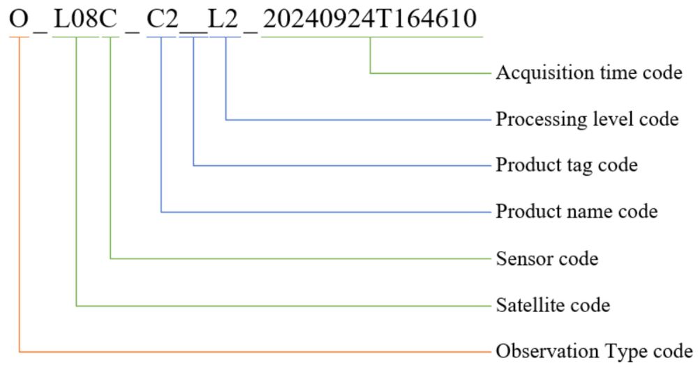
- A globally unique identifier for remote sensing data? Do you think this would be helpful? What is your take? It would provide a framework, tagging each image with key information like satellite name, sensor, acquisition time, etc. Wang et al: doi.org/10.3390/rs17030465 #earthobs #remote…
- If you are interested in pansharpening, you might find this collection useful. github.com/Lihui-Chen/Awesome-… #earthobservation