- Isochrones show you the reachable area from a location for a given travel mode. In #rstats, creating isochrones with @Mapbox web services is easier than you think.May 9, 2025 14:49
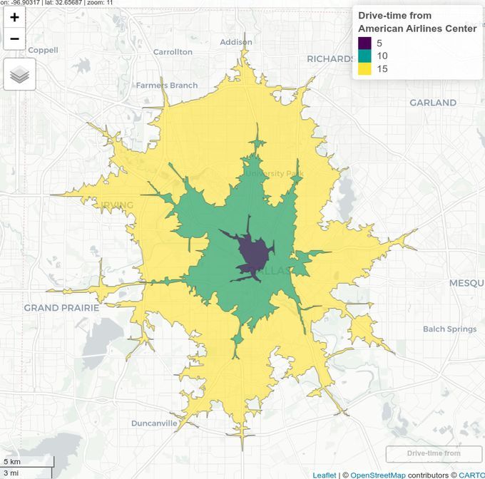
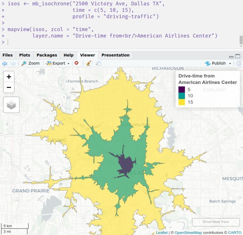
- 🌎 In the mapboxapi R package, the function `mb_isochrone()` helps you calculate isochrones with some extra features to make your life easier. For example, `mb_isochrone()` is integrated with Mapbox's geocoder so you can create isochrones directly from addresses!
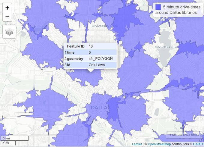
- 🌎 Alternatively, if you have an sf POINT object you can calculate isochrones in bulk over each location. Use the `id_column` argument to associate your isochrones with your input points.
- 🌎 If you want to measure driving distances instead of times, swap in the `distance` argument or use a different travel profile. Supported profiles are "driving-traffic", "driving", "cycling", and "walking".
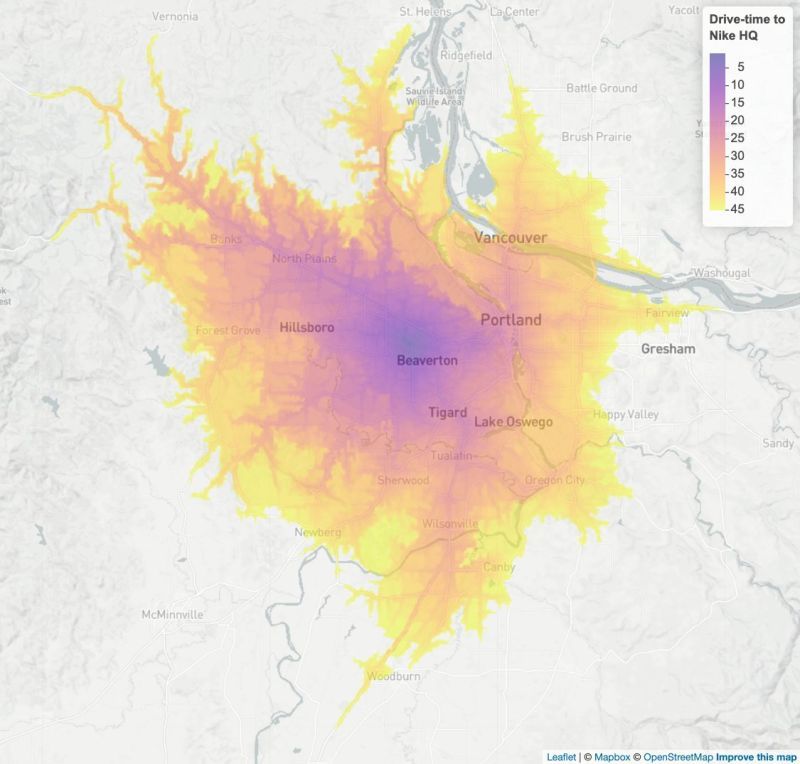
- 🌎 You can even integrate isochrones into more advanced workflows. One of my favorites is the "accessibility surface" - a raster that shows the travel time from any location within an hour. mapboxapi handles Mapbox's rate limits for you, so you can calculate without worry!
- Try out the script here to get started: gist.github.com/walk... And check out the package docs: walker-data.com/mapb... If you are interested in how you can leverage isochrones in your application / business, don't hesitate to reach out!